Publications
Books and Book Editorships
Gołuch P.
Zastosowanie fotogrametrii jednoobrazowej w precyzyjnych pomiarach 3D wzajemnego położenia elementów monitorowanego obiektu
Wydawnictwo Uniwersytetu Przyrodniczego we Wrocławiu, Wrocław 2019, p. 208
DOI: 10.30825/1.9.2019
URL: https://epnp.pl/ebook/A08936_zastosowanie
Chapters in books
Arnold D., Montenbruck O., Hackel S., Sośnica K.
Satellite Laser Ranging to Low Earth Orbiters - Orbit and Network Validation
[in:] Swiss National Report on the Geodetic Activities in the years 2015-2019, edited by J. Mueller-Gantenbein, E. Brockmann, U. Marti, M. Rothacher, B. Merminod, Swiss Geodetic Commission, Zürich, Switzerland 2019, pp. 46-48
URL: https://www.sgc.ethz.ch/sgc-volumes/sgk-report-2015-2019.pdf
Publications in ISI journals
Arnold D., Montenbruck O., Hackel S., Sośnica K.
Satellite laser ranging to low Earth orbiters: orbit and network validation
Journal of Geodesy, Vol. 93 No. 11, Berlin Heidelberg, Germany 2019, pp. 2315-2334
DOI: 10.1007/s00190-018-1140-4
URL: https://doi.org/10.1007/s00190-018-1140-4
Bury G., Sośnica K., Zajdel R.
Multi-GNSS orbit determination using satellite laser ranging
Journal of Geodesy, Vol. 93 No. 12, Berlin Heidelberg, Germany 2019, pp. 2447-2463
DOI: 10.1007/s00190-018-1143-1
URL: https://link.springer.com/article/10.1007/s00190-018-1143-1
Bury G., Sośnica K., Zajdel R.
Impact of the Atmospheric Non-tidal Pressure Loading on Global Geodetic Parameters Based on Satellite Laser Ranging to GNSS
IEEE Transactions on Geoscience and Remote Sensing, Vol. 57 No. 6, Pasadena, CA, USA 2019, pp. 3574-3590
DOI: 10.1109/TGRS.2018.2885845
URL: https://ieeexplore.ieee.org/document/8605502
Bury G., Zajdel R., Sośnica K.
Accounting for perturbing forces acting on Galileo using a box-wing model
GPS Solutions, Vol. 23 No. 74, Berlin - Heidelberg 2019, pp. 1-12
DOI: 10.1007/s10291-019-0860-0
URL: https://link.springer.com/article/10.1007/s10291-019-0860-0
Drożdżewski M., Sośnica K., Zus F., Balidakis K.
Troposphere delay modeling with horizontal gradients for satellite laser ranging
Journal of Geodesy, Vol. 93 No. 10, Berlin Heidelberg, Germany 2019, pp. 1853-1866
DOI: 10.1007/s00190-019-01287-1
URL: https://link.springer.com/article/10.1007/s00190-019-01287-1
Hadaś E., Jóźków G., Walicka A., Borkowski A.
Apple orchard inventory with a LiDAR equipped unmanned aerial system
International Journal of Applied Earth Observation and Geoinformation, Vol. 82 No. 101911, Amsterdam, the Netherlands 2019, pp. 1-20
DOI: 10.1016/j.jag.2019.101911
URL: https://www.sciencedirect.com/science/article/pii/S0303243419302922
Hadaś T., Kaźmierski K., Sośnica K.
Performance of Galileo-only dual-frequency absolute positioning using the fully serviceable Galileo constellation
GPS Solutions, Vol. 23 No. 108, Berlin - Heidelberg 2019, pp. 1-12
DOI: 10.1007/s10291-019-0900-9
URL: https://link.springer.com/article/10.1007/s10291-019-0900-9
Hanna N., Trzcina E., Möller G., Rohm W., Weber R.
Assimilation of GNSS tomography products into the Weather Research and Forecasting model using radio occultation data assimilation operator
Atmospheric Measurement Techniques, Vol. 12 No. 9, Göttingen, Germany 2019, pp. 4829-4848
DOI: 10.5194/amt-12-4829-2019
URL: https://www.atmos-meas-tech.net/12/4829/2019/
Hordyniec P., Huang C.-Y., Liu C.-Y., Rohm W., Chen S.-Y.
GNSS radio occultation profiles in the neutral atmosphere from inversion of excess phase data
Terrestrial Atmospheric and Oceanic Sciences, Vol. 30 No. 2, Taipei, Taiwan, China 2019, pp. 215-233
DOI: 10.3319/TAO.2018.10.12.01
URL: http://tao.cgu.org.tw/index.php/articles/archive/space-science/item/1625-2018101201aa
Hordyniec P., Norman R., Rohm W., Huang C.-Y., Le Marshall J.
Effects of Liquid Clouds on GPS Radio Occultation Profiles in Superrefractions
Earth and Space Science, Vol. 6 No. 8, Hoboken, NJ, USA 2019, pp. 1498-1511
DOI: 10.1029/2019EA000721
Ilieva M., Polanin P., Borkowski A., Gruchlik P., Smolak K., Kowalski A., Rohm W.
Mining Deformation Life Cycle in the Light of InSAR and Deformation Models
Remote Sensing, Vol. 11 (7) No. 145, Basel, Switzerland 2019, pp. 1-30
DOI: 10.3390/rs11070745
URL: https://www.mdpi.com/2072-4292/11/7/745
Kaczmarek A.
Influence of Geophysical Signals on Coordinate Variations GNSS Permanent Stations in Central Europe
Artificial Satellites, Journal of Planetary Geodesy, Vol. 54 No. 3, Warsaw, Poland 2019, pp. 57-71
DOI: 10.2478/arsa-2019-0006
URL: https://content.sciendo.com/view/journals/arsa/54/3/article-p57.xml
Katsigianni G., Loyer S., Perosanz F., Mercier F., Zajdel R., Sośnica K.
Improving Galileo orbit determination using zero-difference ambiguity fixing in a Multi-GNSS processing
Advances in Space Research, Vol. 63 No. 9, 2019, pp. 2952-2963
DOI: 10.1016/j.asr.2018.08.035.
URL: https://www.sciencedirect.com/science/article/pii/S027311771830663X?via%3Dihub
Keller W., Borkowski A.
Thin plate spline interpolation
Journal of Geodesy, Vol. 93 No. 9, Berlin Heidelberg, Germany 2019, pp. 1251-1269
DOI: 10.1007/s00190-019-01240-2
URL: https://link.springer.com/article/10.1007/s00190-019-01240-2
Kucharski D., Kirchner G., Otsubo T., Kunimori H., Jah M. K., Koidl F., Bennett J. C., Lim H.-C., Wang P., Steindorfer M., Sośnica K.
Hypertemporal photometric measurement of spaceborne mirrors specular reflectivity for Laser Time Transfer link model
Advances in Space Research, Vol. 64 No. 4, 2019, pp. 957-963
DOI: 10.1016/j.asr.2019.05.030
URL: https://www.sciencedirect.com/science/article/pii/S0273117719303576
Kudłacik I., Kapłon J., Bosy J., Lizurek G.
Seismic Phenomena in the Light High-Rate GPS Precise Point Positioning Results
Acta Geodynamica et Geomaterialia, Vol. 16 No. 1 (193), Prague, Czech Republic 2019, pp. 99-112
DOI: 10.13168/AGG.2019.0008
URL: https://www.irsm.cas.cz/index_en.php?page=acta_detail_doi&id=291
Le Marshall J., Norman R., Howard D., Rennie S., Moore M., Kapłon J., Xiao Y., Zhang K., Wang C., Cate A., Lehmann P., Wang X., Steinle P., Tingwell C., Le T. , Rohm W., Ren D.
Using global navigation satellite system data for real-time moisture analysis and forecasting over the Australian region I. The system
Journal of Southern Hemisphere Earth Systems Science, Vol. 69 No. 1, Clayton, VIC, Australia 2019, pp. 161-171
DOI: 10.1071/ES19009_CO
URL: https://www.publish.csiro.au/es/ES19009
Meyer U., Sośnica K., Arnold D., Dahle C., Thaller D., Dach R., Jäggi A.
SLR, GRACE and Swarm Gravity Field Determination and Combination
Remote Sensing, Vol. 11 (8) No. 956, Basel, Switzerland 2019, pp. 1-22
DOI: 10.3390/rs11080956
URL: https://www.mdpi.com/2072-4292/11/8/956
Osada E., Owczarek-Wesołowska M., Sośnica K.
Gauss-Helmert Model for Total Station Positioning Directly in Geocentric Reference Frame Including GNSS Reference Points and Vertical Direction from Earth Gravity Model
Journal of Surveying Engineering, Vol. 145 No. 4, Reston, VA, USA 2019, pp. 1-8
DOI: 10.1061/(ASCE)SU.1943-5428.0000287
URL: https://ascelibrary.org/doi/10.1061/%28ASCE%29SU.1943-5428.0000287
Otsubo T., Müller H., Pavlis E. C., Torrence M. H., Thaller D., Glotov V. D., Wang X., Sośnica K., Meyer U, Wilkinson M. J.
Rapid response quality control service for the laser ranging tracking network
Journal of Geodesy, Vol. 93 No. 11, Berlin Heidelberg, Germany 2019, pp. 2335-2344
DOI: 10.1007/s00190-018-1197-0
URL: https://link.springer.com/article/10.1007/s00190-018-1197-0
Pawłuszek K.
Landslide features identification and morphology investigation using high-resolution DEM derivatives
Natural Hazards, Vol. 96 No. 1, New York, USA 2019, pp. 311-330
DOI: 10.1007/s11069-018-3543-1
URL: https://link.springer.com/article/10.1007/s11069-018-3543-1
Pawłuszek K., Marczak S., Borkowski A., Tarolli P.
Multi-Aspect Analysis of Object-Oriented Landslide Detection Based on an Extended Set of LiDAR-Derived Terrain Features
ISPRS International Journal of Geo-Information, Vol. 8 (8) No. 321, Basel, Switzerland 2019
DOI: 10.3390/ijgi8080321
URL: https://www.mdpi.com/2220-9964/8/8/321
Pearlman M., Arnold D., Davis M., Barlier F., Biancale R., Vasiliev V., Ciufolini I., Paolozzi A., Pavlis E. C., Sośnica K., Bloßfeld M.
Laser geodetic satellites: a high-accuracy scientific tool
Journal of Geodesy, Vol. 93 No. 11, Berlin Heidelberg, Germany 2019, pp. 2181-2194
DOI: 10.1007/s00190-019-01228-y
URL: https://link.springer.com/article/10.1007/s00190-019-01228-y
Rohm W., Guzikowski J., Wilgan K., Kryza M.
4DVAR assimilation of GNSS zenith path delays and precipitable water into a numerical weather prediction model WRF
Atmospheric Measurement Techniques, Vol. 12 No. 1, Göttingen, Germany 2019, pp. 345-361
DOI: 10.5194/amt-12-345-2019
URL: https://www.atmos-meas-tech.net/12/345/2019/
Sośnica K., Bury G., Zajdel R., Strugarek D., Drożdżewski M., Kaźmierski K.
Estimating global geodetic parameters using SLR observations to Galileo, GLONASS, BeiDou, GPS, and QZSS
Earth, Planets and Space, Vol. 71 No. 20, London, UK & Nagoya, Japan 2019, pp. 1-11
DOI: 10.1186/s40623-019-1000-3
URL: https://earth-planets-space.springeropen.com/articles/10.1186/s40623-019-1000-3
Strugarek D., Sośnica K., Arnold D., Jäggi A., Zajdel R., Bury G., Drożdżewski M.
Determination of Global Geodetic Parameters Using Satellite Laser Ranging Measurements to Sentinel-3 Satellites
Remote Sensing, Vol. 11 (19) No. 2282, Basel, Switzerland 2019, pp. 1-21
DOI: 10.3390/rs11192282
URL: https://www.mdpi.com/2072-4292/11/19/2282
Strugarek D., Sośnica K., Jäggi A.
Characteristics of GOCE orbits based on Satellite Laser Ranging
Advances in Space Research, Vol. 63 No. 1, 2019, pp. 417-431
DOI: 10.1016/j.asr.2018.08.033
URL: https://www.sciencedirect.com/science/article/pii/S0273117718306616
Trojanowicz M.
Local Disturbing Potential Model with the Use of Geophysical Gravity Data Inversion Case Study in the Area of Poland
Acta Geodynamica et Geomaterialia, Vol. 16 No. 3 (195), Prague, Czech Republic 2019, pp. 293-299
DOI: 10.13168/AGG.2019.0025
URL: https://www.irsm.cas.cz/index_en.php?page=acta_detail_doi&id=309
Trzcina E., Rohm W.
Estimation of 3D wet refractivity by tomography, combining GNSS and NWP data: First results from assimilation of wet refractivity into NWP
Quarterly Journal of the Royal Meteorological Society, Vol. 145 No. , Hoboken, New Jersey, USA 2019, pp. 1034-1051
DOI: 10.1002/qj.3475
URL: https://rmets.onlinelibrary.wiley.com/doi/10.1002/qj.3475
Tymków P., Jóźków G., Walicka A., Karpina M., Borkowski A.
Identification of Water Body Extent Based on Remote Sensing Data Collected with Unmanned Aerial Vehicle
Water, Vol. 11 (2) No. 338, Basel, Switzerland 2019, pp. 1-20
DOI: 10.3390/w11020338
URL: https://www.mdpi.com/2073-4441/11/2/338
Walicka A., Jóźków G., Kasprzak M., Borkowski A.
Terrestrial Laser Scanning for the Detection of Coarse Grain Size Movement in a Mountain Riverbed
Water, Vol. 11 (11) No. 2199, Basel, Switzerland 2019, pp. 1-20
DOI: 10.3390/w11112199
URL: https://www.mdpi.com/2073-4441/11/11/2199
Wilgan K., Geiger A.
High-resolution models of tropospheric delays and refractivity based on GNSS and numerical weather prediction data for alpine regions in Switzerland
Journal of Geodesy, Vol. 93 No. 6, Berlin Heidelberg, Germany 2019, pp. 819-835
DOI: 10.1007/s00190-018-1203-6
URL: https://link.springer.com/article/10.1007/s00190-018-1203-6
Yuan Y., Holden L., Kealy A., Choy S., Hordyniec P.
Assessment of forecast Vienna Mapping Function 1 for real-time tropospheric delay modeling in GNSS
Journal of Geodesy, Vol. 93 No. 9, Berlin Heidelberg, Germany 2019, pp. 1501-1514
DOI: 10.1007/s00190-019-01263-9
URL: https://link.springer.com/article/10.1007/s00190-019-01263-9
Zajdel R., Sośnica K., Dach R., Bury G., Prange L., Jäggi A.
Network effects and handling of the geocenter motion in multi-GNSS processing
Journal of Geophysical Research-Solid Earth, Vol. 124 No. 6, Washington, DC, USA 2019, pp. 5970-5989
DOI: 10.1029/2019JB017443
Zajdel R., Sośnica K., Drożdżewski M., Bury G., Strugarek D.
Impact of network constraining on the terrestrial reference frame realization based on SLR observations to LAGEOS
Journal of Geodesy, Vol. 93 No. 11, Berlin Heidelberg, Germany 2019, pp. 2293-2313
DOI: 10.1007/s00190-019-01307-0
URL: https://link.springer.com/article/10.1007%2Fs00190-019-01307-0
Publications in scientific journals
Borkowski A., Kosek W., Ligas M.
Geodesy: General theory and methodology 2015-2018
Geodesy and Cartography, Vol. 68 No. 1, Warsaw, Poland 2019, pp. 145-162
DOI: 10.24425/gac.2019.126092
URL: http://journals.pan.pl/dlibra/publication/126092/edition/110005/content
Bryś H., Ćmielewski K.
Geodezja tunelowa - nowa generacja poziomych sieci realizacyjnych na początku XXI wieku
Przegląd Geodezyjny, Vol. XCI No. 7, Warszawa 2019, pp. 12-17
DOI: 10.15199/50.2019.7.1
URL: http://sigma-not.pl/publikacja-121205-geodezja-tunelowa---nowa-generacja-poziomych-sieci-r (...)
Bryś H., Ćmielewski K.
Monitoring geodezyjny ułożenia kół jezdnych suwnicy: tolerancje - metodyka pomiaru - instrumentarium
Przegląd Geodezyjny, Vol. XCI No. 11, Warszawa 2019, pp. 9-12
DOI: 10.15199/50.2019.11.1
URL: http://sigma-not.pl/publikacja-123327-monitoring-geodezyjny-ułożenia-kół-jezdnych-suwnicy: (...)
Bryś H., Ćmielewski K.
Niwelacyjny system pomiarowy z zastosowaniem laserowej stopki sygnalizacyjnej
Przegląd Geodezyjny, Vol. XCI No. 2, Warszawa 2019, pp. 19-21
DOI: 10.15199/50.2019.2.2
URL: http://sigma-not.pl/publikacja-118463-niwelacyjny-system-pomiarowy-z-zastosowaniem-laserow (...)
Bryś H., Ćmielewski K., Trojanowicz M.
Precise integrated hybrid networks in 21st-century tunnel surveying
Geomatics, Landmanagement and Landscape, Vol. No. 4, Kraków 2019, pp. 7-22
DOI: 10.15576/GLL/2019.4.7
URL: https://gll.urk.edu.pl/zasoby/74/GLL-4-1-2019.pdf
Bryś H., Ćmielewski K., Trojanowicz M., Wilczyńska I.
Aliniometr pływakowo-laserowy do monitoringu przemieszczeń elementów konstrukcji budowlanych
Przegląd Geodezyjny, Vol. XCI No. 10, Warszawa 2019, pp. 9-12
DOI: 10.15199/50.2019.10.1
URL: http://sigma-not.pl/publikacja-122681-aliniometr-pływakowo-laserowy-do-monitoringu-przemie (...)
Bryś H., Ćmielewski K., Wilczyńska I.
Eksperymentalne badania wpływu przesłonięcia wiązki pomiarowej dalmierza elektrooptycznego na wyniki precyzyjnych pomiarów odległości w pomieszczeniu zamkniętym
Przegląd Geodezyjny, Vol. XCI No. 5, Warszawa 2019, pp. 13-16
DOI: 10.15199/50.2019.5.1
URL: http://sigma-not.pl/publikacja-120031-eksperymentalne-badania-wpływu-przesłonięcia-wiazki- (...)
Mutke G., Kotyrba A., Lurka A., Olszewska D., Dykowski P., Borkowski A., Araszkiewicz A., Barański A.
Upper Silesian Geophysical Observation System A unit of the EPOS project
Journal of Sustainable Mining, Vol. 18 No. 4, Amsterdam, the Nethetrlands 2019, pp. 198-207
DOI: 10.1016/j.jsm.2019.07.005
URL: https://www.sciencedirect.com/science/article/pii/S2300396019300990
Patynowski P.
SKN Geodetów UPWr
Przegląd Geodezyjny, Vol. XCI No. 7, Warszawa 2019, pp. 1
URL: https://sigma-not.pl/publikacja-121214-skn-geodet%C3%B3w-upwr-przeglad-geodezyjny-2019-7.html
Smolak K., Kasieczka B., Siła-Nowicka K., Kopańczyk K., Rohm W., Fiałkiewicz W.
Urban Hourly Water Demand Prediction Using Human Mobility Data
IEEE Digital Library. Proceedings of 2018 IEEE/ACM 5th International Conference on Big Data Computing Applications and Technologies (BDCAT), Zürich, Switzerland, 17-20.12.2018, Vol. online No. , Zürich, Switzerland 2019, pp. 213-214
DOI: 10.1109/BDCAT.2018.00036
URL: https://ieeexplore.ieee.org/document/8606656
Sośnica K., Bosy J.
Global Geodetic Observing System 2015-2018
Geodesy and Cartography, Vol. 68 No. 1, Warsaw, Poland 2019, pp. 121-144
DOI: 10.24425/gac.2019.126090
URL: http://journals.pan.pl/dlibra/publication/126090/edition/110003/content
Walicka A., Pfeifer N., Jóźków G., Borkowski A.
TLS Point Cloud Registration for Detecting Change in Individual Rocks of a Mountain River Bed
The International Archives of the Photogrammetry, Remote Sensing and Spatial Information Sciences (ISPRS Archives), Vol. XLII-2/W13 No. Commission II, WG II/3, Enschede, The Netherlands 2019, pp. 1149-1154
DOI: 10.5194/isprs-archives-XLII-2-W13-1149-2019
URL: https://www.int-arch-photogramm-remote-sens-spatial-inf-sci.net/XLII-2-W13/1149/2019/
Wielgocka N., Hadaś T.
Czy to już możliwe?
Geodeta. Magazyn Geoinformacyjny, Vol. 4 No. (287), Warszawa 2019, pp. 8-12
URL: https://geoforum.pl/wydanie/1292/artykul/3193/natalia-wielgocka-tomasz-hadas-czy-to-juz-mo (...)
Wielgosz P., Hadaś T., Kłos A., Paziewski J.
Research on GNSS positioning and applications in Poland in 2015-2018
Geodesy and Cartography, Vol. 68 No. 1, Warsaw, Poland 2019, pp. 87-119
DOI: 10.24425/gac.2019.126089
URL: http://journals.pan.pl/dlibra/publication/126089/edition/110002/content
Conference proceedings
Adavi Z., Rohm W., Weber R.
Analysing different parameterisation methods in GNSS Tomography using the COST benchmark dataset
European Geosciences Union General Assembly 2019, Vienna, Austria, 7-12 April 2019. Geophysical Research Abstracts (poster, materiały konferencyjne), pp. 1
URL: https://meetingorganizer.copernicus.org/EGU2019/EGU2019-18797-1.pdf
Bloßfeld M., Meyer U., Sośnica K., Jäggi A.
Combined SLR gravity field time series for continuous Earth System Monitoring
European Geosciences Union General Assembly 2019, Vienna, Austria, 7-12 April 2019. Geophysical Research Abstracts (referat, materiały konferencyjne), pp. 1
URL: https://meetingorganizer.copernicus.org/EGU2019/EGU2019-13183.pdf
Borkowski A., Pawłuszek K.
Monitoring of terrain subsidence caused by coal mining using combined differential and SBAS Sentinel-1 SAR interferometry - Rydultowy case study, Poland
European Geosciences Union General Assembly 2019, Vienna, Austria, 7-12 April 2019. Geophysical Research Abstracts (referat, materiały konferencyjne), pp. 1
URL: https://meetingorganizer.copernicus.org/EGU2019/EGU2019-6641.pdf
Bryłka P., Tondaś D., Hadaś T., Kapłon J.
Low-cost Receivers for GNSS meteorology
GNSS Meteorology Workshop 2019, 19-20.09.2019, Wrocław (prezentacja, materiały konferencyjne), pp. 1-16
URL: http://www.igig.up.wroc.pl/download/2020-07-31_TH2019_LowCost.pdf
Bryś H., Ćmielewski K., Goluch P., Kuchmister J.
Automatyczny system monitoringu prowadnic wind
XIV Konferencja Naukowo-Techniczna z cyklu Aktualne Problemy w Geodezji Inżynieryjnej pt.: "Trendy rozwojowe w monitorowaniu obiektów inżynierskich i terenu", Chęciny, 4-6 kwietnia 2019 r. , pp. 13
URL: http://www.igig.up.wroc.pl/download/KN-T_Checiny_2019_streszczenia.pdf
Bury G., Sośnica k., Zajdel R, Strugarek D., Kaźmierski K., Hadaś T.
Challenges in the modeling of perturbing forces acting on Galileo orbits
7th International Colloquium on Scientific and Fundamental Aspects of GNSS, European Space Agency, 4-6 September 2019, ETH Zürich, Zurich, Switzerland (referat, materiały konferencyjne), pp. 1
URL: https://atpi.eventsair.com/QuickEventWebsitePortal/19a07---7th-gnss-colloquium/7th-interna (...)
Bury G., Sośnica K., Zajdel R., Strugarek D.
Empirical versus physical models for Galileo satellites: Assessment of the orbit quality and predictions
ESA 2019 Living Planet Symposium, MiCo - Milano Congressi, Milan, Italy, 13-17.05.2019 (poster, materiały konferencyjne), pp. 1
URL: https://www.researchgate.net/publication/334634968_Empirical_versus_physical_models_for_Ga (...)
Bury G., Sośnica K., Zajdel R., Strugarek D.
Precise Galileo orbits as a basis for the precise GNSS-based products
27th General Assembly of the International Union of Geodesy and Geophysics (IUGG), Montréal, Québec, Canada, July 8-18, 2019 (referat, materiały konferencyjne), pp. 1
URL: https://www.czech-in.org/cmPortalV15/CM_W3_Searchable/iugg19/normal#!abstractdetails/0000746680
Bury G., Sośnica K., Zajdel R., Strugarek D., Kaźmierski K.
Processing of Satellite Laser Ranging Data to GNSS Satellites at IGiG WUELS
2019 ILRS Technical Workshop, Stuttgart, Germany, October 21-25, 2019 (poster, materiały konferencyjne), pp. 1
URL: https://ilrsworkshop2019.besl-eventservice.de/archiv/web/userfiles/ILRS_WS_booklet.pdf?&mo (...)
Bury G., Sośnica K., Zajdel R., Strugarek D., Kaźmierski K.
Processing of the Satellite Laser Ranging data to the Galileo satellites at WUELS
7th International Colloquium on Scientific and Fundamental Aspects of GNSS, European Space Agency, 4-6 September 2019, ETH Zürich, Zurich, Switzerland (referat, materiały konferencyjne), pp. 1
URL: https://atpi.eventsair.com/QuickEventWebsitePortal/19a07---7th-gnss-colloquium/7th-interna (...)
Bury G., Zajdel R., Sośnica K.
Processing of Satellite Laser Ranging to GNSS Satellites
20th Czech-Polish Workshop "On Recent Geodynamics of Central Europe" and the 2nd Symposium of the Committee on Geodesy of the Polish Academy of Sciences, Szklarska Poręba - Jakuszyce, Poland, October 24-26, 2019 (poster, materiały konferencyjne), pp. 13
URL: http://www.igig.up.wroc.pl/download/20th_Cz-P_Workshop_2019_Jakuszyce_Abstracts.pdf
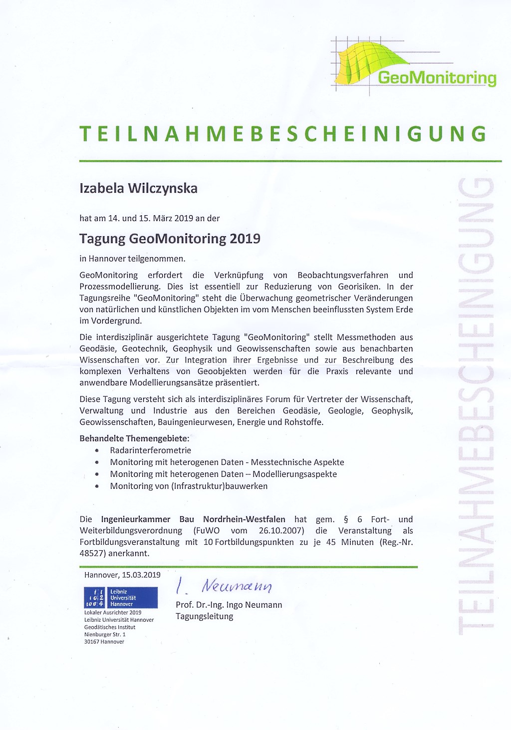
Ćmielewski K., Gołuch P., Kuchmister J., Wilczyńska I., Kowalski K.
Koncepcje zestawu przyrządów do testowania pionowników wbudowanych w spodarki instrumentów geodezyjnych
XIV Konferencja Naukowo-Techniczna z cyklu Aktualne Problemy w Geodezji Inżynieryjnej pt.: "Trendy rozwojowe w monitorowaniu obiektów inżynierskich i terenu", Chęciny, 4-6 kwietnia 2019 r. , pp. 15
URL: http://www.igig.up.wroc.pl/download/KN-T_Checiny_2019_streszczenia.pdf
Ćmielewski K., Jamroz O., Gołuch P., Kuchmister J., Mąkolski K.
Przyrządy geodezyjne do pomiarów przemieszczeń
XIV Konferencja Naukowo-Techniczna z cyklu Aktualne Problemy w Geodezji Inżynieryjnej pt.: "Trendy rozwojowe w monitorowaniu obiektów inżynierskich i terenu", Chęciny, 4-6 kwietnia 2019 r. , pp. 16
URL: http://www.igig.up.wroc.pl/download/KN-T_Checiny_2019_streszczenia.pdf
Ćmielewski K., Kuchmister J., Gołuch P., Wilczyńska I., Ćmielewski B., Kowalski K.
Geodetic control networks for engineering objects using optoelectronic techniques
Tagung GeoMonitoring 2019, Hannover, Germany, 14.-15.03.2019 (poster, materiały konferencyjne), pp. 1
URL: http://www.igig.up.wroc.pl/download/Wilczynska_Tagung_Hannover_2019.jpg
Drożdżewski M., Sośnica K., Zus F., Balidakis K., Boisits J., Böhm J., Bury G., Zajdel R., Strugarek D.
Troposphere delay modeling in SLR solutions
2019 ILRS Technical Workshop, Stuttgart, Germany, October 21-25, 2019 (poster, materiały konferencyjne), pp. 1
URL: https://ilrsworkshop2019.besl-eventservice.de/archiv/web/userfiles/ILRS_WS_booklet.pdf?&mo (...)
Drożdżewski M., Sośnica K., Zus F., Balidakis K.
Enhanced troposphere delay model for SLR
European Geosciences Union General Assembly 2019, Vienna, Austria, 7-12 April 2019. Geophysical Research Abstracts (poster, materiały konferencyjne), pp. 1
URL: https://meetingorganizer.copernicus.org/EGU2019/EGU2019-1697.pdf
Gołuch P., Ćmielewski K., Kuchmister J., Ćmielewski B., Wilczyńska I.
Station to Testing of Vertical Digital Inclinometer SISGEO
20th Czech-Polish Workshop "On Recent Geodynamics of Central Europe" and the 2nd Symposium of the Committee on Geodesy of the Polish Academy of Sciences, Szklarska Poręba - Jakuszyce, Poland, October 24-26, 2019 (poster, materiały konferencyjne), pp. 17
URL: http://www.igig.up.wroc.pl/download/20th_Cz-P_Workshop_2019_Jakuszyce_Abstracts.pdf
Hadaś E., Jóźkow G, Borkowski A., Walicka A.
Remote sensing of selected geometric parameters of apple trees using unmanned aerial system equipped with laser scanner
European Geosciences Union General Assembly 2019, Vienna, Austria, 7-12 April 2019. Geophysical Research Abstracts (poster, materiały konferencyjne), pp. 1
URL: https://meetingorganizer.copernicus.org/EGU2019/EGU2019-10889.pdf
Hadaś E., Jóźków G., Borkowski A., Walicka A.
Determination of Tree Height and Crown Base Height of Apple Trees from UAS LiDAR
27th General Assembly of the International Union of Geodesy and Geophysics (IUGG), Montréal, Québec, Canada, July 8-18, 2019 (poster, materiały konferencyjne), pp. 1
URL: https://www.czech-in.org/cmPortalV15/CM_W3_Searchable/iugg19/normal#!abstractdetails/0000745130
Hadaś E., Thalia N., Vaclavovic P., Shi J., Kapłon J., Jóźków G., Karpina M.
Determination of UAV Trajectory Using Absolute and Relative GNSS Positioning
27th General Assembly of the International Union of Geodesy and Geophysics (IUGG), Montréal, Québec, Canada, July 8-18, 2019 (poster, materiały konferencyjne), pp. 1
URL: https://www.czech-in.org/cmPortalV15/CM_W3_Searchable/iugg19/normal#!abstractdetails/0000756600
Hadaś T., Hobiger T.
GNSS meteorology: state of the art, challenges and perspectives
Second Summer School of DAAD Thematic Network, Stuttgart, Germany, 09.10.2019 (prezentacja, materiały konferencyjne), pp. 1-29
URL: http://www.igig.up.wroc.pl/download/2020-07-31_TH_DAAD2019.pdf
Hadaś T., Hobiger T.
Real-time GNSS meteorology: state of the art and challenges
EMS Annual Meeting 2019, Bratislava, Slovakia, 7-11.09.2019 (prezentacja, materiały konferencyjne), pp. 1
URL: https://meetingorganizer.copernicus.org/EMS2019/EMS2019-902.pdf
Hadaś T., Kaźmierski K., Sośnica K.
Evaluation of Galileo-Only Dual-Frequency Absolute Standard and Precise Positioning
27th General Assembly of the International Union of Geodesy and Geophysics (IUGG), Montréal, Québec, Canada, July 8-18, 2019 (referat, materiały konferencyjne), pp. 1
URL: https://www.czech-in.org/cmPortalV15/CM_W3_Searchable/iugg19/normal#!abstractdetails/0000745020
Hadaś T., Kaźmierski K., Sośnica K.
Performance of Galileo-only positioning using the current Galileo constellation
7th International Colloquium on Scientific and Fundamental Aspects of GNSS, European Space Agency, 4-6 September 2019, ETH Zürich, Zurich, Switzerland (referat, materiały konferencyjne), pp. 1
URL: https://atpi.eventsair.com/QuickEventWebsitePortal/19a07---7th-gnss-colloquium/7th-interna (...)
Hadaś T., Kaźmierski K., Sośnica K.
Galileo-only positioning for the present Galileo constellation
The EUREF Analysis Centres Workshop, October 16-17, 2019, Warsaw, Poland (referat, materiały konferencyjne), pp. 1-17
URL: http://www.epncb.oma.be/_newseventslinks/workshops/EPNLACWS_2019/pdf/4.03_KK_EUREF_worksho (...)
Hadaś T., Turbańska-Guźniczak A., Kaźmierski K., Sośnica K.
Inter-system weighting for improved multi-GNSS real-time ZTD estimation
European Geosciences Union General Assembly 2019, Vienna, Austria, 7-12 April 2019. Geophysical Research Abstracts (referat, materiały konferencyjne), pp. 1
URL: https://meetingorganizer.copernicus.org/EGU2019/EGU2019-13099.pdf
Hordyniec P., Rohm W., Norman R., Huang C.-Y.
Effects of liquid and ice clouds on GNSS radio occultation profiles
European Geosciences Union General Assembly 2019, Vienna, Austria, 7-12 April 2019. Geophysical Research Abstracts (poster, materiały konferencyjne), pp. 1
URL: https://meetingorganizer.copernicus.org/EGU2019/EGU2019-12255.pdf
Ilieva M., Borkowski A., Rohm W., Polanin P., Gruchlik P., Smolak K., Kowalski A.
Mine subsidence-cycle monitoring by use of Sentinel-1 data
European Geosciences Union General Assembly 2019, Vienna, Austria, 7-12 April 2019. Geophysical Research Abstracts (poster, materiały konferencyjne), pp. 1
URL: https://meetingorganizer.copernicus.org/EGU2019/EGU2019-14120-1.pdf
Ilieva M., Polanin P., Tondaś D., Gruchlik P., Borkowski A. Kapłon J., Hadaś T., Smolak K., Kowalski A., Rohm W.
Multi-source Modelling of Land Surface Deformations Caused by Extensive Mining Exploitation
27th General Assembly of the International Union of Geodesy and Geophysics (IUGG), Montréal, Québec, Canada, July 8-18, 2019 (referat, materiały konferencyjne), pp. 1
URL: https://www.czech-in.org/cmPortalV15/CM_W3_Searchable/iugg19/normal#!abstractdetails/0000753090
Kaczmarek A., Kontny B.
Analysis of the impact range of geophysical deformations on changes in GNSS station coordinates
European Geosciences Union General Assembly 2019, Vienna, Austria, 7-12 April 2019. Geophysical Research Abstracts (poster, materiały konferencyjne), pp. 1
URL: https://meetingorganizer.copernicus.org/EGU2019/EGU2019-14001.pdf
Kaczmarek A., Kontny B.
Comparison of Coordinate Changes of GNSS Stations with Geophysical Deformations of the Surface of the Earth's Crust
27th General Assembly of the International Union of Geodesy and Geophysics (IUGG), Montréal, Québec, Canada, July 8-18, 2019 (poster, materiały konferencyjne), pp. 1
URL: https://www.czech-in.org/cmPortalV15/CM_W3_Searchable/iugg19/normal#!abstractdetails/0000796470
Karpina M., Tymków P.
GIS 3D jako narzędzie do integracji, prezentacji i analizy danych geofizycznych
VIII Ogólnopolska Konferencja "GIS w Nauce", Wrocław, 10-11 czerwca 2019 (poster, materiały konferencyjne), pp. 74
Kaźmierski K., Hadaś T., Sośnica K.
Permanent Validation of the Real-time Multi-GNSS Clock and Orbit Corrections
27th General Assembly of the International Union of Geodesy and Geophysics (IUGG), Montréal, Québec, Canada, July 8-18, 2019 (referat, materiały konferencyjne), pp. 1
URL: https://www.czech-in.org/cmPortalV15/CM_W3_Searchable/iugg19/normal#!abstractdetails/0000746710
Kaźmierski K., Hadaś T., Sośnica K.
A service for the validation of the real-time GNSS orbit and clock quality
7th International Colloquium on Scientific and Fundamental Aspects of GNSS, European Space Agency, 4-6 September 2019, ETH Zürich, Zurich, Switzerland (referat, materiały konferencyjne), pp. 1
URL: https://atpi.eventsair.com/QuickEventWebsitePortal/19a07---7th-gnss-colloquium/7th-interna (...)
Kryński J., Olszewska D., Górka-Kostrubiec B., Lizurek G., Jóźwiak W., Werner T., Araszkiewicz A., Czuba W., Sośnica K., Mutke G., Szepieniec T.
EPOS PL Polish national infrastructure fulfilling European Plate Observing System goals
27th General Assembly of the International Union of Geodesy and Geophysics (IUGG), Montréal, Québec, Canada, July 8-18, 2019 (poster, materiały konferencyjne), pp. 1
URL: https://www.czech-in.org/cmPortalV15/CM_W3_Searchable/iugg19/normal#!abstractdetails/0000741560
Kubiś P., Kulik A., Łuczak J., Marczak S., Murdza J., Sabatowska M., Tymków P., Jarzembowski P.
Integracja danych przestrzennych 2D i 3D dla systemu zarządzania zespołem pałacowo-parkowym w Pawłowicach (Wrocław)
VIII Ogólnopolska Konferencja "GIS w Nauce", Wrocław, 10-11 czerwca 2019 (poster, materiały konferencyjne), pp. 86
Kuchmister J., Ćmielewski K., Gołuch P., Jamroz O., Wilczyńska I., Ćmielewski B.
Autorska aparatura pomiarowa do monitorowania przemieszczeń
XIV Konferencja Naukowo-Techniczna z cyklu Aktualne Problemy w Geodezji Inżynieryjnej pt.: "Trendy rozwojowe w monitorowaniu obiektów inżynierskich i terenu", Chęciny, 4-6 kwietnia 2019 r. , pp. 27
URL: http://www.igig.up.wroc.pl/download/KN-T_Checiny_2019_streszczenia.pdf
Kuchmister J., Ćmielewski K., Gołuch P., Wilczyńska I., Ćmielewski B., Kowalski K.
Wyznaczenie przemieszczeń ściany nośnej budynku z użyciem pionu optoelektronicznego
XIV Konferencja Naukowo-Techniczna z cyklu Aktualne Problemy w Geodezji Inżynieryjnej pt.: "Trendy rozwojowe w monitorowaniu obiektów inżynierskich i terenu", Chęciny, 4-6 kwietnia 2019 r. , pp. 28
URL: http://www.igig.up.wroc.pl/download/KN-T_Checiny_2019_streszczenia.pdf
Kudłacik I., Kapłon J., Hadaś T., Bosy J.
Correction of multipath effect for precise point positioning high-rate GNSS data processing in seismic phenomena analysis
European Geosciences Union General Assembly 2019, Vienna, Austria, 7-12 April 2019. Geophysical Research Abstracts (poster, materiały konferencyjne), pp. 1
URL: https://meetingorganizer.copernicus.org/EGU2019/EGU2019-13012.pdf
Kudłacik I., Kapłon J., Lizurek G.
High-Rate GNSS for Mining Activity: the 2019 January 29th Mining Tremor in Legnica-Głogów Copper District, Poland
20th Czech-Polish Workshop "On Recent Geodynamics of Central Europe" and the 2nd Symposium of the Committee on Geodesy of the Polish Academy of Sciences, Szklarska Poręba - Jakuszyce, Poland, October 24-26, 2019 (referat, materiały konferencyjne), pp. 25
URL: http://www.igig.up.wroc.pl/download/20th_Cz-P_Workshop_2019_Jakuszyce_Abstracts.pdf
Lasota E., Rohm W., Liu C.-Y., Hordyniec P.
Cloud Detection from Radio Occultation Measurements in Tropical Cyclones
European Geosciences Union General Assembly 2019, Vienna, Austria, 7-12 April 2019. Geophysical Research Abstracts (poster, materiały konferencyjne), pp. 1
URL: https://meetingorganizer.copernicus.org/EGU2019/EGU2019-2384.pdf
Marciniak R., Ilieva M., Rohm W., Guerova G.
Tropospheric Sentinel-1 phase delay corrections for the purposes of DInSAR studies
European Geosciences Union General Assembly 2019, Vienna, Austria, 7-12 April 2019. Geophysical Research Abstracts (poster, materiały konferencyjne), pp. 1
URL: https://meetingorganizer.copernicus.org/EGU2019/EGU2019-7698.pdf
Meyer u., Sośnica K., Andritsch F., König D., Dach R., Thaller D., Jäggi A.
Combination of SLR, GRACE and SWARM monthly gravity fields at normal equation level
European Geosciences Union General Assembly 2019, Vienna, Austria, 7-12 April 2019. Geophysical Research Abstracts (poster, materiały konferencyjne), pp. 1
URL: https://meetingorganizer.copernicus.org/EGU2019/EGU2019-7581.pdf
Pawłuszek K., Marczak S., Borkowski A., Tarolli P.
Landslide detection using object oriented approach and LiDAR-derived DEM
European Geosciences Union General Assembly 2019, Vienna, Austria, 7-12 April 2019. Geophysical Research Abstracts (poster, materiały konferencyjne), pp. 1
URL: https://meetingorganizer.copernicus.org/EGU2019/EGU2019-1040.pdf
Pawłuszek K., Marczak S., Borkowski A., Tarolli P.
Identyfikacja osuwisk na obszarach rolniczych i zalesionych z wykorzystaniem obiektowej analizy obrazów i danych LiDAR
2. Ogólnopolska Konferencja Osuwiskowa O!SUWISKO 2019, Szczawnica, Poland, 14-17 maja 2019 (referat, materiały konferencyjne), pp. 1
Pawłuszek K., Marczak S., Borkowski A., Tarolli P.
Landslide identification in forested and agricultural areas using Object-Based Image Analysis and LiDAR data
AGU Fall Meeting 2019, San Francisco, Ca, USA, 9-13 December 2019 (poster, materiały konferencyjne), pp. 1
URL: https://ui.adsabs.harvard.edu/abs/2019AGUFMNH33D0938P/abstract
Pawłuszek-Filipiak K., Borkowski A.
SBAS and DInSAR Technique Integration for Mining Subsidence Monitoring in the Rydułtowy Mine in Poland
39th Annual EARSeL Symposium Digital Earth Observation, Salzburg, Austria, 1-4 July 2019 (referat, materiały konferencyjne), pp. 132-133
URL: http://symposium.earsel.org/39th-symposium-Salzburg/wp-content/uploads/2019/07/EARSeL-2019 (...)
Porzucek S., Jamroz O., Łój M.
Gravimetric Modelling of Eastern Edge of Upper Nysa Klodzka Graben
20th Czech-Polish Workshop "On Recent Geodynamics of Central Europe" and the 2nd Symposium of the Committee on Geodesy of the Polish Academy of Sciences, Szklarska Poręba - Jakuszyce, Poland, October 24-26, 2019 (referat, materiały konferencyjne), pp. 35
URL: http://www.igig.up.wroc.pl/download/20th_Cz-P_Workshop_2019_Jakuszyce_Abstracts.pdf
Rohm W., Adavi Z., Weber R.
Application of Turbulence Theory in GNSS Tomography for Computing Wet refractivity Variance-Covariance Matrix
27th General Assembly of the International Union of Geodesy and Geophysics (IUGG), Montréal, Québec, Canada, July 8-18, 2019 (poster, materiały konferencyjne), pp. 1
URL: https://www.czech-in.org/cmPortalV15/CM_W3_Searchable/iugg19/normal#!abstractdetails/0000757090
Rohm W., Hugues B., Kačmařík M., Möller G., Landskron D., Trzcina E., Hanna N., Sa A., Adavi z., Tondaś D., Rapant L., Biondi R.
GNSS Tomography Working Group Achievements In Model Validation, Quality Assurance, Severe Weather Studies and Assimilation
27th General Assembly of the International Union of Geodesy and Geophysics (IUGG), Montréal, Québec, Canada, July 8-18, 2019 (referat, materiały konferencyjne), pp. 1
URL: https://www.czech-in.org/cmPortalV15/CM_W3_Searchable/iugg19/normal#!abstractdetails/0000751910
Rohm W., Kapłon J., Ilieva M., Kudłacik I., Tondaś D., Pawłuszek K., Hadaś T., Kaźmierski K., Sośnica K., Zajdel R., Jóźków G., Tymków P., Karpina M., Borkowski A.
Scientific Use of EPOS-PL Infrastructure
20th Czech-Polish Workshop "On Recent Geodynamics of Central Europe" and the 2nd Symposium of the Committee on Geodesy of the Polish Academy of Sciences, Szklarska Poręba - Jakuszyce, Poland, October 24-26, 2019 (referat, materiały konferencyjne), pp. 37
URL: http://www.igig.up.wroc.pl/download/20th_Cz-P_Workshop_2019_Jakuszyce_Abstracts.pdf
Rohm W., Kotyrba A., Mutke G., Olszewska D., Borkowski A., Dykowski P., Sękowski M., Lizurek G., Urban P.
Multidisciplinary Upper Silesian Episode a Multidisciplinary Approach in Building Research Infrastructure for Observation of Geodynamic Processes Related to Industrial Activity
27th General Assembly of the International Union of Geodesy and Geophysics (IUGG), Montréal, Québec, Canada, July 8-18, 2019 (poster, materiały konferencyjne), pp. 1
URL: https://www.czech-in.org/cmPortalV15/CM_W3_Searchable/iugg19/normal#!abstractdetails/0000757040
Rohm W., Trzcina E., Smolak K.
GNSS tomography model reparametrization
European Geosciences Union General Assembly 2019, Vienna, Austria, 7-12 April 2019. Geophysical Research Abstracts (referat, materiały konferencyjne), pp. 1
URL: https://meetingorganizer.copernicus.org/EGU2019/EGU2019-13281.pdf
Schenk V., Schenková Z., Kontny B., Kapłon J.
An Appropriate Lithospheric Plate Velocity Model for the Central European Area
20th Czech-Polish Workshop "On Recent Geodynamics of Central Europe" and the 2nd Symposium of the Committee on Geodesy of the Polish Academy of Sciences, Szklarska Poręba - Jakuszyce, Poland, October 24-26, 2019 (referat, materiały konferencyjne), pp. 38
URL: http://www.igig.up.wroc.pl/download/20th_Cz-P_Workshop_2019_Jakuszyce_Abstracts.pdf
Sośnica K., Bury G., Zajdel R.
Precise orbit determination of Galileo satellites based on hybrid empirical-physical models
European Geosciences Union General Assembly 2019, Vienna, Austria, 7-12 April 2019. Geophysical Research Abstracts (poster, materiały konferencyjne), pp. 1
URL: https://meetingorganizer.copernicus.org/EGU2019/EGU2019-3926.pdf
Sośnica K., Bury G., Zajdel R., Kaźmierski K., Strugarek D., Hadaś T.
Measurements of the Galileo orbit geometry deformations caused by the general relativity
7th International Colloquium on Scientific and Fundamental Aspects of GNSS, European Space Agency, 4-6 September 2019, ETH Zürich, Zurich, Switzerland (referat, materiały konferencyjne), pp. 1
URL: https://atpi.eventsair.com/QuickEventWebsitePortal/19a07---7th-gnss-colloquium/7th-interna (...)
Sośnica K., Drożdżewski M., Bury G., Zus F., Balidakis K.
Consequences of Neglecting Horizontal Gradients of the Troposphere Delay in SLR Solutions
27th General Assembly of the International Union of Geodesy and Geophysics (IUGG), Montréal, Québec, Canada, July 8-18, 2019 (referat, materiały konferencyjne), pp. 1
URL: https://www.czech-in.org/cmPortalV15/CM_W3_Searchable/iugg19/normal#!abstractdetails/0000752590
Sośnica K., Drożdżewski M., Zus F., Balidakis K., Boisits J. , Böhm J.
Proposed Model for Horizontal Tropospheric Refraction Gradients
Unified Analysis Workshop 2019. Advancing Geodesy. Institut de Physique du Globe de Paris, October 2-4, 2019, Paris, France (referat, materiały konferencyjne), pp. 1
URL: https://www.researchgate.net/publication/336284799_Proposed_model_for_horizontal_troposphe (...)
Sośnica K., Najder J., Zajdel R., Bury G., Strugarek D.
Quality of Orbit Predictions for Satellites Tracked by SLR Stations
2019 ILRS Technical Workshop, Stuttgart, Germany, October 21-25, 2019 (referat, materiały konferencyjne), pp. 1
URL: https://ilrsworkshop2019.besl-eventservice.de/archiv/web/userfiles/ILRS_WS_booklet.pdf?&mo (...)
Sowa W., Kaczmarek A., Mąkolski K.
Analysis of Vertical Displacements of the Geo-Info-Hydro Building Based on the Observation from the Structural Monitoring System
20th Czech-Polish Workshop "On Recent Geodynamics of Central Europe" and the 2nd Symposium of the Committee on Geodesy of the Polish Academy of Sciences, Szklarska Poręba - Jakuszyce, Poland, October 24-26, 2019 (poster, materiały konferencyjne), pp. 41
URL: http://www.igig.up.wroc.pl/download/20th_Cz-P_Workshop_2019_Jakuszyce_Abstracts.pdf
Sowa W., Kaczmarek A., Waliński T., Czerwonka M., Borkowski A.
Data Analysis of the Surveying Monitoring System Operating in Open-Cast Mine Conditions - First Results
20th Czech-Polish Workshop "On Recent Geodynamics of Central Europe" and the 2nd Symposium of the Committee on Geodesy of the Polish Academy of Sciences, Szklarska Poręba - Jakuszyce, Poland, October 24-26, 2019 (referat, materiały konferencyjne), pp. 42
URL: http://www.igig.up.wroc.pl/download/20th_Cz-P_Workshop_2019_Jakuszyce_Abstracts.pdf
Strugarek D., Sośnica K., Arnold D.
Determination of global geodetic parameters and station coordinates based on SLR measurements to Sentinel-3A/3B and precise GNSS orbits
ESA 2019 Living Planet Symposium, 13-17 May 2019, Milan, Italy (referat, materiały konferencyjne), pp. 1
URL: https://lps19.esa.int/NikalWebsitePortal/living-planet-symposium-2019/lps19/Agenda/AgendaI (...)
Strugarek D., Sośnica K., Arnold D., Jäggi A., Bury G., Zajdel R.
Realization of the terrestrial reference frame based on integrated SLR measurements to LEO, LAGEOS, and Galileo satellites
7th International Colloquium on Scientific and Fundamental Aspects of GNSS, European Space Agency, 4-6 September 2019, ETH Zürich, Zurich, Switzerland (referat, materiały konferencyjne), pp. 1
URL: https://atpi.eventsair.com/QuickEventWebsitePortal/19a07---7th-gnss-colloquium/7th-interna (...)
Strugarek D., Sośnica K., Arnold D., Jäggi A., Bury G., Zajdel R.
Realization of Reference Frames based on Integrated SLR Measurements to LEO and LAGEOS Satellites
27th General Assembly of the International Union of Geodesy and Geophysics (IUGG), Montréal, Québec, Canada, July 8-18, 2019 (referat, materiały konferencyjne), pp. 1
URL: https://www.czech-in.org/cmPortalV15/CM_W3_Searchable/iugg19/normal#!abstractdetails/0000752680
Strugarek D., Sośnica K., Arnold D., Jäggi A., Bury G., Zajdel R.
Realization of the terrestrial reference frame based on integrated SLR measurements to LEO, geodetic, and Galileo satellites
2019 ILRS Technical Workshop, Stuttgart, Germany, October 21-25, 2019 (poster, materiały konferencyjne), pp. 1
URL: https://ilrsworkshop2019.besl-eventservice.de/archiv/web/userfiles/ILRS_WS_booklet.pdf?&mo (...)
Tondaś D., Kapłon J., Rohm W.
Investigation for mining-induced deformation in Upper Silesia Coal Basin with GNSS observations in reduced latency near real-time mode
European Geosciences Union General Assembly 2019, Vienna, Austria, 7-12 April 2019. Geophysical Research Abstracts (poster, materiały konferencyjne), pp. 1
URL: https://meetingorganizer.copernicus.org/EGU2019/EGU2019-13231.pdf
Tondaś D., Pawłuszek K., Ilieva M., Kapłon J., Rohm W.
Investigation for mining induced deformation in Upper Silesia Coal Basin with multi GNSS in Near Real Time
4th Joint International Symposium on Deformation Monitoring, Athens, Greece, 15-17.05.2019 (poster, materiały konferencyjne), pp. 1
URL: http://www.igig.up.wroc.pl/download/JISDM_2019_Damian_Tondas.pdf
Trojanowicz M., Pospíšil L., Jamroz O.
The Use of the Unb_TopoDens Model for Local Modelling of Chosen Gravity Field Parameters at the Western Carpathians Area
20th Czech-Polish Workshop "On Recent Geodynamics of Central Europe" and the 2nd Symposium of the Committee on Geodesy of the Polish Academy of Sciences, Szklarska Poręba - Jakuszyce, Poland, October 24-26, 2019 (poster, materiały konferencyjne), pp. 46
URL: http://www.igig.up.wroc.pl/download/20th_Cz-P_Workshop_2019_Jakuszyce_Abstracts.pdf
Trzcina E., Rohm W., Kapłon J.
GNSS tomography data assimilation into the NWP models
European Geosciences Union General Assembly 2019, Vienna, Austria, 7-12 April 2019. Geophysical Research Abstracts (poster, materiały konferencyjne), pp. 1
URL: https://meetingorganizer.copernicus.org/EGU2019/EGU2019-12957.pdf
Walicka A., Jóźków G., Borkowski A., Rohm W.
UAS Based Terrain Deformation Monitoring Caused by Underground Mining
27th General Assembly of the International Union of Geodesy and Geophysics (IUGG), Montréal, Québec, Canada, July 8-18, 2019 (poster, materiały konferencyjne), pp. 1
URL: https://www.czech-in.org/cmPortalV15/CM_W3_Searchable/iugg19/normal#!abstractdetails/0000758060
Walicka A., Pfeifer N., Jóźków G., Borkowski A.
Displacement Detection of Individual Rocks in a Mountain River Bed by Means of TLS Point Cloud Registration
27th General Assembly of the International Union of Geodesy and Geophysics (IUGG), Montréal, Québec, Canada, July 8-18, 2019 (referat, materiały konferencyjne), pp. 1
URL: https://www.czech-in.org/cmPortalV15/CM_W3_Searchable/iugg19/normal#!abstractdetails/0000758030
Weigelt M., Jäggi A., Meyer U., Arnold D., Mayer-Gürr T., Zehentner N., Vishwakarma B. D., Devaraju B., Steffen H., Sośnica K.
Bridging the Gap between GRACE and GRACE-Follow On - the Final Series from HLSST and SLR
27th General Assembly of the International Union of Geodesy and Geophysics (IUGG), Montréal, Québec, Canada, July 8-18, 2019 (referat, materiały konferencyjne), pp. 1
URL: https://www.czech-in.org/cmPortalV15/CM_W3_Searchable/iugg19/normal#!abstractdetails/0000797490
Werner T., Olszewska D., Górka-Kostrubiec B., Lizurek G., Jóźwiak W., Kryński J., Czuba W., Rohm W., Araszkiewicz A., Mutke G., Sterzel M., Szepieniec T., Wójcik D.
EPOS PL - Polish national contribution towards EPOS infrastructure
European Geosciences Union General Assembly 2019, Vienna, Austria, 7-12 April 2019. Geophysical Research Abstracts (poster, materiały konferencyjne), pp. 1
URL: https://meetingorganizer.copernicus.org/EGU2019/EGU2019-13968.pdf
Wielgosz P. Hadaś T., Hernandes-Pajares M., Puciłowski M., Orus-Perez R., Krypiak-Gregorczyk A., Rapiński J., Paziewski J., Tomaszewski D., Ostapkiewicz M., Kaźmierski K., Kapłon J., Sośnica K., Bosy J., Garcia-Rigo A., Monte-Moreno E., Yang H., Portasiak
Ionospheric modelling for enhanced precise GNSS services and transference to the Industry (HORION, PIOM-FIPP and ATOMIC ESA - funded projects)
7th International Colloquium on Scientific and Fundamental Aspects of GNSS, European Space Agency, 4-6 September 2019, ETH Zürich, Zurich, Switzerland (referat, materiały konferencyjne), pp. 1
URL: https://atpi.eventsair.com/QuickEventWebsitePortal/19a07---7th-gnss-colloquium/7th-interna (...)
Wilczyńska I., Ćmielewski B.
Analiza deformacji obiektu zabytkowego na przykładzie kościoła Krzyża Świętego w Ząbkowicach Śląskich
XIV Konferencja Naukowo-Techniczna z cyklu Aktualne Problemy w Geodezji Inżynieryjnej pt.: "Trendy rozwojowe w monitorowaniu obiektów inżynierskich i terenu", Chęciny, 4-6 kwietnia 2019 r. , pp. 52
URL: http://www.igig.up.wroc.pl/download/KN-T_Checiny_2019_streszczenia.pdf
Wilczyńska I., Ćmielewski B., Dąbek P., Patrzałek C.
Potential of Unmanned Aircraft Systems for land surface monitoring (case of Janowiec)
Tagung GeoMonitoring 2019, Hannover, Germany, 14.-15.03.2019 (poster, materiały konferencyjne), pp. 1
URL: http://www.igig.up.wroc.pl/download/Wilczynska_Tagung_Hannover_2019.jpg
Zajdel R., Sośnica K., Bury G., Dach R., Prange L.
Determination of geocenter coordinates and Earth rotation parameters based on Galileo observations
European Geosciences Union General Assembly 2019, Vienna, Austria, 7-12 April 2019. Geophysical Research Abstracts (poster, materiały konferencyjne), pp. 1
URL: https://meetingorganizer.copernicus.org/EGU2019/EGU2019-1335.pdf
Zajdel R., Sośnica K., Bury G., Kaźmierski K., Strugarek D.
Sub-Daily Earth Rotation Parameters from GPS, Glonass and Galileo
20th Czech-Polish Workshop "On Recent Geodynamics of Central Europe" and the 2nd Symposium of the Committee on Geodesy of the Polish Academy of Sciences, Szklarska Poręba - Jakuszyce, Poland, October 24-26, 2019 (referat, materiały konferencyjne), pp. 56
URL: http://www.igig.up.wroc.pl/download/20th_Cz-P_Workshop_2019_Jakuszyce_Abstracts.pdf
Zajdel R., Sośnica K., Dach R., Bury G.
Handling of geocenter motion in the GNSS solutions
7th International Colloquium on Scientific and Fundamental Aspects of GNSS, European Space Agency, 4-6 September 2019, ETH Zürich, Zurich, Switzerland (referat, materiały konferencyjne), pp. 1
URL: https://atpi.eventsair.com/QuickEventWebsitePortal/19a07---7th-gnss-colloquium/7th-interna (...)
Zajdel R., Sośnica K., Dach R., Bury G.
Galileo-based Earth rotation parameters derived with a daily and sub-daily resolution
7th International Colloquium on Scientific and Fundamental Aspects of GNSS, European Space Agency, 4-6 September 2019, ETH Zürich, Zurich, Switzerland (referat, materiały konferencyjne), pp. 1
URL: https://atpi.eventsair.com/QuickEventWebsitePortal/19a07---7th-gnss-colloquium/7th-interna (...)
Zajdel R., Sośnica K., Dach R., Bury G., Prange L.
Galileo-based Earth rotation parameters with sub-daily resolution
27th General Assembly of the International Union of Geodesy and Geophysics (IUGG), Montréal, Québec, Canada, July 8-18, 2019 (referat, materiały konferencyjne), pp. 1
URL: https://www.czech-in.org/cmPortalV15/CM_W3_Searchable/iugg19/normal#!abstractdetails/0000747000
Zastosowanie fotogrametrii jednoobrazowej w precyzyjnych pomiarach 3D wzajemnego położenia elementów monitorowanego obiektu
Wydawnictwo Uniwersytetu Przyrodniczego we Wrocławiu, Wrocław 2019, p. 208
DOI: 10.30825/1.9.2019
URL: https://epnp.pl/ebook/A08936_zastosowanie
Satellite Laser Ranging to Low Earth Orbiters - Orbit and Network Validation
[in:] Swiss National Report on the Geodetic Activities in the years 2015-2019, edited by J. Mueller-Gantenbein, E. Brockmann, U. Marti, M. Rothacher, B. Merminod, Swiss Geodetic Commission, Zürich, Switzerland 2019, pp. 46-48
URL: https://www.sgc.ethz.ch/sgc-volumes/sgk-report-2015-2019.pdf
Satellite laser ranging to low Earth orbiters: orbit and network validation
Journal of Geodesy, Vol. 93 No. 11, Berlin Heidelberg, Germany 2019, pp. 2315-2334
DOI: 10.1007/s00190-018-1140-4
URL: https://doi.org/10.1007/s00190-018-1140-4
Multi-GNSS orbit determination using satellite laser ranging
Journal of Geodesy, Vol. 93 No. 12, Berlin Heidelberg, Germany 2019, pp. 2447-2463
DOI: 10.1007/s00190-018-1143-1
URL: https://link.springer.com/article/10.1007/s00190-018-1143-1
Impact of the Atmospheric Non-tidal Pressure Loading on Global Geodetic Parameters Based on Satellite Laser Ranging to GNSS
IEEE Transactions on Geoscience and Remote Sensing, Vol. 57 No. 6, Pasadena, CA, USA 2019, pp. 3574-3590
DOI: 10.1109/TGRS.2018.2885845
URL: https://ieeexplore.ieee.org/document/8605502
Accounting for perturbing forces acting on Galileo using a box-wing model
GPS Solutions, Vol. 23 No. 74, Berlin - Heidelberg 2019, pp. 1-12
DOI: 10.1007/s10291-019-0860-0
URL: https://link.springer.com/article/10.1007/s10291-019-0860-0
Troposphere delay modeling with horizontal gradients for satellite laser ranging
Journal of Geodesy, Vol. 93 No. 10, Berlin Heidelberg, Germany 2019, pp. 1853-1866
DOI: 10.1007/s00190-019-01287-1
URL: https://link.springer.com/article/10.1007/s00190-019-01287-1
Apple orchard inventory with a LiDAR equipped unmanned aerial system
International Journal of Applied Earth Observation and Geoinformation, Vol. 82 No. 101911, Amsterdam, the Netherlands 2019, pp. 1-20
DOI: 10.1016/j.jag.2019.101911
URL: https://www.sciencedirect.com/science/article/pii/S0303243419302922
Performance of Galileo-only dual-frequency absolute positioning using the fully serviceable Galileo constellation
GPS Solutions, Vol. 23 No. 108, Berlin - Heidelberg 2019, pp. 1-12
DOI: 10.1007/s10291-019-0900-9
URL: https://link.springer.com/article/10.1007/s10291-019-0900-9
Assimilation of GNSS tomography products into the Weather Research and Forecasting model using radio occultation data assimilation operator
Atmospheric Measurement Techniques, Vol. 12 No. 9, Göttingen, Germany 2019, pp. 4829-4848
DOI: 10.5194/amt-12-4829-2019
URL: https://www.atmos-meas-tech.net/12/4829/2019/
GNSS radio occultation profiles in the neutral atmosphere from inversion of excess phase data
Terrestrial Atmospheric and Oceanic Sciences, Vol. 30 No. 2, Taipei, Taiwan, China 2019, pp. 215-233
DOI: 10.3319/TAO.2018.10.12.01
URL: http://tao.cgu.org.tw/index.php/articles/archive/space-science/item/1625-2018101201aa
Effects of Liquid Clouds on GPS Radio Occultation Profiles in Superrefractions
Earth and Space Science, Vol. 6 No. 8, Hoboken, NJ, USA 2019, pp. 1498-1511
DOI: 10.1029/2019EA000721
Mining Deformation Life Cycle in the Light of InSAR and Deformation Models
Remote Sensing, Vol. 11 (7) No. 145, Basel, Switzerland 2019, pp. 1-30
DOI: 10.3390/rs11070745
URL: https://www.mdpi.com/2072-4292/11/7/745
Influence of Geophysical Signals on Coordinate Variations GNSS Permanent Stations in Central Europe
Artificial Satellites, Journal of Planetary Geodesy, Vol. 54 No. 3, Warsaw, Poland 2019, pp. 57-71
DOI: 10.2478/arsa-2019-0006
URL: https://content.sciendo.com/view/journals/arsa/54/3/article-p57.xml
Improving Galileo orbit determination using zero-difference ambiguity fixing in a Multi-GNSS processing
Advances in Space Research, Vol. 63 No. 9, 2019, pp. 2952-2963
DOI: 10.1016/j.asr.2018.08.035.
URL: https://www.sciencedirect.com/science/article/pii/S027311771830663X?via%3Dihub
Thin plate spline interpolation
Journal of Geodesy, Vol. 93 No. 9, Berlin Heidelberg, Germany 2019, pp. 1251-1269
DOI: 10.1007/s00190-019-01240-2
URL: https://link.springer.com/article/10.1007/s00190-019-01240-2
Hypertemporal photometric measurement of spaceborne mirrors specular reflectivity for Laser Time Transfer link model
Advances in Space Research, Vol. 64 No. 4, 2019, pp. 957-963
DOI: 10.1016/j.asr.2019.05.030
URL: https://www.sciencedirect.com/science/article/pii/S0273117719303576
Seismic Phenomena in the Light High-Rate GPS Precise Point Positioning Results
Acta Geodynamica et Geomaterialia, Vol. 16 No. 1 (193), Prague, Czech Republic 2019, pp. 99-112
DOI: 10.13168/AGG.2019.0008
URL: https://www.irsm.cas.cz/index_en.php?page=acta_detail_doi&id=291
Using global navigation satellite system data for real-time moisture analysis and forecasting over the Australian region I. The system
Journal of Southern Hemisphere Earth Systems Science, Vol. 69 No. 1, Clayton, VIC, Australia 2019, pp. 161-171
DOI: 10.1071/ES19009_CO
URL: https://www.publish.csiro.au/es/ES19009
SLR, GRACE and Swarm Gravity Field Determination and Combination
Remote Sensing, Vol. 11 (8) No. 956, Basel, Switzerland 2019, pp. 1-22
DOI: 10.3390/rs11080956
URL: https://www.mdpi.com/2072-4292/11/8/956
Gauss-Helmert Model for Total Station Positioning Directly in Geocentric Reference Frame Including GNSS Reference Points and Vertical Direction from Earth Gravity Model
Journal of Surveying Engineering, Vol. 145 No. 4, Reston, VA, USA 2019, pp. 1-8
DOI: 10.1061/(ASCE)SU.1943-5428.0000287
URL: https://ascelibrary.org/doi/10.1061/%28ASCE%29SU.1943-5428.0000287
Rapid response quality control service for the laser ranging tracking network
Journal of Geodesy, Vol. 93 No. 11, Berlin Heidelberg, Germany 2019, pp. 2335-2344
DOI: 10.1007/s00190-018-1197-0
URL: https://link.springer.com/article/10.1007/s00190-018-1197-0
Landslide features identification and morphology investigation using high-resolution DEM derivatives
Natural Hazards, Vol. 96 No. 1, New York, USA 2019, pp. 311-330
DOI: 10.1007/s11069-018-3543-1
URL: https://link.springer.com/article/10.1007/s11069-018-3543-1
Multi-Aspect Analysis of Object-Oriented Landslide Detection Based on an Extended Set of LiDAR-Derived Terrain Features
ISPRS International Journal of Geo-Information, Vol. 8 (8) No. 321, Basel, Switzerland 2019
DOI: 10.3390/ijgi8080321
URL: https://www.mdpi.com/2220-9964/8/8/321
Laser geodetic satellites: a high-accuracy scientific tool
Journal of Geodesy, Vol. 93 No. 11, Berlin Heidelberg, Germany 2019, pp. 2181-2194
DOI: 10.1007/s00190-019-01228-y
URL: https://link.springer.com/article/10.1007/s00190-019-01228-y
4DVAR assimilation of GNSS zenith path delays and precipitable water into a numerical weather prediction model WRF
Atmospheric Measurement Techniques, Vol. 12 No. 1, Göttingen, Germany 2019, pp. 345-361
DOI: 10.5194/amt-12-345-2019
URL: https://www.atmos-meas-tech.net/12/345/2019/
Estimating global geodetic parameters using SLR observations to Galileo, GLONASS, BeiDou, GPS, and QZSS
Earth, Planets and Space, Vol. 71 No. 20, London, UK & Nagoya, Japan 2019, pp. 1-11
DOI: 10.1186/s40623-019-1000-3
URL: https://earth-planets-space.springeropen.com/articles/10.1186/s40623-019-1000-3
Determination of Global Geodetic Parameters Using Satellite Laser Ranging Measurements to Sentinel-3 Satellites
Remote Sensing, Vol. 11 (19) No. 2282, Basel, Switzerland 2019, pp. 1-21
DOI: 10.3390/rs11192282
URL: https://www.mdpi.com/2072-4292/11/19/2282
Characteristics of GOCE orbits based on Satellite Laser Ranging
Advances in Space Research, Vol. 63 No. 1, 2019, pp. 417-431
DOI: 10.1016/j.asr.2018.08.033
URL: https://www.sciencedirect.com/science/article/pii/S0273117718306616
Local Disturbing Potential Model with the Use of Geophysical Gravity Data Inversion Case Study in the Area of Poland
Acta Geodynamica et Geomaterialia, Vol. 16 No. 3 (195), Prague, Czech Republic 2019, pp. 293-299
DOI: 10.13168/AGG.2019.0025
URL: https://www.irsm.cas.cz/index_en.php?page=acta_detail_doi&id=309
Estimation of 3D wet refractivity by tomography, combining GNSS and NWP data: First results from assimilation of wet refractivity into NWP
Quarterly Journal of the Royal Meteorological Society, Vol. 145 No. , Hoboken, New Jersey, USA 2019, pp. 1034-1051
DOI: 10.1002/qj.3475
URL: https://rmets.onlinelibrary.wiley.com/doi/10.1002/qj.3475
Identification of Water Body Extent Based on Remote Sensing Data Collected with Unmanned Aerial Vehicle
Water, Vol. 11 (2) No. 338, Basel, Switzerland 2019, pp. 1-20
DOI: 10.3390/w11020338
URL: https://www.mdpi.com/2073-4441/11/2/338
Terrestrial Laser Scanning for the Detection of Coarse Grain Size Movement in a Mountain Riverbed
Water, Vol. 11 (11) No. 2199, Basel, Switzerland 2019, pp. 1-20
DOI: 10.3390/w11112199
URL: https://www.mdpi.com/2073-4441/11/11/2199
High-resolution models of tropospheric delays and refractivity based on GNSS and numerical weather prediction data for alpine regions in Switzerland
Journal of Geodesy, Vol. 93 No. 6, Berlin Heidelberg, Germany 2019, pp. 819-835
DOI: 10.1007/s00190-018-1203-6
URL: https://link.springer.com/article/10.1007/s00190-018-1203-6
Assessment of forecast Vienna Mapping Function 1 for real-time tropospheric delay modeling in GNSS
Journal of Geodesy, Vol. 93 No. 9, Berlin Heidelberg, Germany 2019, pp. 1501-1514
DOI: 10.1007/s00190-019-01263-9
URL: https://link.springer.com/article/10.1007/s00190-019-01263-9
Network effects and handling of the geocenter motion in multi-GNSS processing
Journal of Geophysical Research-Solid Earth, Vol. 124 No. 6, Washington, DC, USA 2019, pp. 5970-5989
DOI: 10.1029/2019JB017443
Impact of network constraining on the terrestrial reference frame realization based on SLR observations to LAGEOS
Journal of Geodesy, Vol. 93 No. 11, Berlin Heidelberg, Germany 2019, pp. 2293-2313
DOI: 10.1007/s00190-019-01307-0
URL: https://link.springer.com/article/10.1007%2Fs00190-019-01307-0
Geodesy: General theory and methodology 2015-2018
Geodesy and Cartography, Vol. 68 No. 1, Warsaw, Poland 2019, pp. 145-162
DOI: 10.24425/gac.2019.126092
URL: http://journals.pan.pl/dlibra/publication/126092/edition/110005/content
Geodezja tunelowa - nowa generacja poziomych sieci realizacyjnych na początku XXI wieku
Przegląd Geodezyjny, Vol. XCI No. 7, Warszawa 2019, pp. 12-17
DOI: 10.15199/50.2019.7.1
URL: http://sigma-not.pl/publikacja-121205-geodezja-tunelowa---nowa-generacja-poziomych-sieci-r (...)
Monitoring geodezyjny ułożenia kół jezdnych suwnicy: tolerancje - metodyka pomiaru - instrumentarium
Przegląd Geodezyjny, Vol. XCI No. 11, Warszawa 2019, pp. 9-12
DOI: 10.15199/50.2019.11.1
URL: http://sigma-not.pl/publikacja-123327-monitoring-geodezyjny-ułożenia-kół-jezdnych-suwnicy: (...)
Niwelacyjny system pomiarowy z zastosowaniem laserowej stopki sygnalizacyjnej
Przegląd Geodezyjny, Vol. XCI No. 2, Warszawa 2019, pp. 19-21
DOI: 10.15199/50.2019.2.2
URL: http://sigma-not.pl/publikacja-118463-niwelacyjny-system-pomiarowy-z-zastosowaniem-laserow (...)
Precise integrated hybrid networks in 21st-century tunnel surveying
Geomatics, Landmanagement and Landscape, Vol. No. 4, Kraków 2019, pp. 7-22
DOI: 10.15576/GLL/2019.4.7
URL: https://gll.urk.edu.pl/zasoby/74/GLL-4-1-2019.pdf
Aliniometr pływakowo-laserowy do monitoringu przemieszczeń elementów konstrukcji budowlanych
Przegląd Geodezyjny, Vol. XCI No. 10, Warszawa 2019, pp. 9-12
DOI: 10.15199/50.2019.10.1
URL: http://sigma-not.pl/publikacja-122681-aliniometr-pływakowo-laserowy-do-monitoringu-przemie (...)
Eksperymentalne badania wpływu przesłonięcia wiązki pomiarowej dalmierza elektrooptycznego na wyniki precyzyjnych pomiarów odległości w pomieszczeniu zamkniętym
Przegląd Geodezyjny, Vol. XCI No. 5, Warszawa 2019, pp. 13-16
DOI: 10.15199/50.2019.5.1
URL: http://sigma-not.pl/publikacja-120031-eksperymentalne-badania-wpływu-przesłonięcia-wiazki- (...)
Upper Silesian Geophysical Observation System A unit of the EPOS project
Journal of Sustainable Mining, Vol. 18 No. 4, Amsterdam, the Nethetrlands 2019, pp. 198-207
DOI: 10.1016/j.jsm.2019.07.005
URL: https://www.sciencedirect.com/science/article/pii/S2300396019300990
SKN Geodetów UPWr
Przegląd Geodezyjny, Vol. XCI No. 7, Warszawa 2019, pp. 1
URL: https://sigma-not.pl/publikacja-121214-skn-geodet%C3%B3w-upwr-przeglad-geodezyjny-2019-7.html
Urban Hourly Water Demand Prediction Using Human Mobility Data
IEEE Digital Library. Proceedings of 2018 IEEE/ACM 5th International Conference on Big Data Computing Applications and Technologies (BDCAT), Zürich, Switzerland, 17-20.12.2018, Vol. online No. , Zürich, Switzerland 2019, pp. 213-214
DOI: 10.1109/BDCAT.2018.00036
URL: https://ieeexplore.ieee.org/document/8606656
Global Geodetic Observing System 2015-2018
Geodesy and Cartography, Vol. 68 No. 1, Warsaw, Poland 2019, pp. 121-144
DOI: 10.24425/gac.2019.126090
URL: http://journals.pan.pl/dlibra/publication/126090/edition/110003/content
TLS Point Cloud Registration for Detecting Change in Individual Rocks of a Mountain River Bed
The International Archives of the Photogrammetry, Remote Sensing and Spatial Information Sciences (ISPRS Archives), Vol. XLII-2/W13 No. Commission II, WG II/3, Enschede, The Netherlands 2019, pp. 1149-1154
DOI: 10.5194/isprs-archives-XLII-2-W13-1149-2019
URL: https://www.int-arch-photogramm-remote-sens-spatial-inf-sci.net/XLII-2-W13/1149/2019/
Czy to już możliwe?
Geodeta. Magazyn Geoinformacyjny, Vol. 4 No. (287), Warszawa 2019, pp. 8-12
URL: https://geoforum.pl/wydanie/1292/artykul/3193/natalia-wielgocka-tomasz-hadas-czy-to-juz-mo (...)
Research on GNSS positioning and applications in Poland in 2015-2018
Geodesy and Cartography, Vol. 68 No. 1, Warsaw, Poland 2019, pp. 87-119
DOI: 10.24425/gac.2019.126089
URL: http://journals.pan.pl/dlibra/publication/126089/edition/110002/content
Analysing different parameterisation methods in GNSS Tomography using the COST benchmark dataset
European Geosciences Union General Assembly 2019, Vienna, Austria, 7-12 April 2019. Geophysical Research Abstracts (poster, materiały konferencyjne), pp. 1
URL: https://meetingorganizer.copernicus.org/EGU2019/EGU2019-18797-1.pdf
Combined SLR gravity field time series for continuous Earth System Monitoring
European Geosciences Union General Assembly 2019, Vienna, Austria, 7-12 April 2019. Geophysical Research Abstracts (referat, materiały konferencyjne), pp. 1
URL: https://meetingorganizer.copernicus.org/EGU2019/EGU2019-13183.pdf
Monitoring of terrain subsidence caused by coal mining using combined differential and SBAS Sentinel-1 SAR interferometry - Rydultowy case study, Poland
European Geosciences Union General Assembly 2019, Vienna, Austria, 7-12 April 2019. Geophysical Research Abstracts (referat, materiały konferencyjne), pp. 1
URL: https://meetingorganizer.copernicus.org/EGU2019/EGU2019-6641.pdf
Low-cost Receivers for GNSS meteorology
GNSS Meteorology Workshop 2019, 19-20.09.2019, Wrocław (prezentacja, materiały konferencyjne), pp. 1-16
URL: http://www.igig.up.wroc.pl/download/2020-07-31_TH2019_LowCost.pdf
Automatyczny system monitoringu prowadnic wind
XIV Konferencja Naukowo-Techniczna z cyklu Aktualne Problemy w Geodezji Inżynieryjnej pt.: "Trendy rozwojowe w monitorowaniu obiektów inżynierskich i terenu", Chęciny, 4-6 kwietnia 2019 r. , pp. 13
URL: http://www.igig.up.wroc.pl/download/KN-T_Checiny_2019_streszczenia.pdf
Challenges in the modeling of perturbing forces acting on Galileo orbits
7th International Colloquium on Scientific and Fundamental Aspects of GNSS, European Space Agency, 4-6 September 2019, ETH Zürich, Zurich, Switzerland (referat, materiały konferencyjne), pp. 1
URL: https://atpi.eventsair.com/QuickEventWebsitePortal/19a07---7th-gnss-colloquium/7th-interna (...)
Empirical versus physical models for Galileo satellites: Assessment of the orbit quality and predictions
ESA 2019 Living Planet Symposium, MiCo - Milano Congressi, Milan, Italy, 13-17.05.2019 (poster, materiały konferencyjne), pp. 1
URL: https://www.researchgate.net/publication/334634968_Empirical_versus_physical_models_for_Ga (...)
Precise Galileo orbits as a basis for the precise GNSS-based products
27th General Assembly of the International Union of Geodesy and Geophysics (IUGG), Montréal, Québec, Canada, July 8-18, 2019 (referat, materiały konferencyjne), pp. 1
URL: https://www.czech-in.org/cmPortalV15/CM_W3_Searchable/iugg19/normal#!abstractdetails/0000746680
Processing of Satellite Laser Ranging Data to GNSS Satellites at IGiG WUELS
2019 ILRS Technical Workshop, Stuttgart, Germany, October 21-25, 2019 (poster, materiały konferencyjne), pp. 1
URL: https://ilrsworkshop2019.besl-eventservice.de/archiv/web/userfiles/ILRS_WS_booklet.pdf?&mo (...)
Processing of the Satellite Laser Ranging data to the Galileo satellites at WUELS
7th International Colloquium on Scientific and Fundamental Aspects of GNSS, European Space Agency, 4-6 September 2019, ETH Zürich, Zurich, Switzerland (referat, materiały konferencyjne), pp. 1
URL: https://atpi.eventsair.com/QuickEventWebsitePortal/19a07---7th-gnss-colloquium/7th-interna (...)
Processing of Satellite Laser Ranging to GNSS Satellites
20th Czech-Polish Workshop "On Recent Geodynamics of Central Europe" and the 2nd Symposium of the Committee on Geodesy of the Polish Academy of Sciences, Szklarska Poręba - Jakuszyce, Poland, October 24-26, 2019 (poster, materiały konferencyjne), pp. 13
URL: http://www.igig.up.wroc.pl/download/20th_Cz-P_Workshop_2019_Jakuszyce_Abstracts.pdf
Koncepcje zestawu przyrządów do testowania pionowników wbudowanych w spodarki instrumentów geodezyjnych
XIV Konferencja Naukowo-Techniczna z cyklu Aktualne Problemy w Geodezji Inżynieryjnej pt.: "Trendy rozwojowe w monitorowaniu obiektów inżynierskich i terenu", Chęciny, 4-6 kwietnia 2019 r. , pp. 15
URL: http://www.igig.up.wroc.pl/download/KN-T_Checiny_2019_streszczenia.pdf
Przyrządy geodezyjne do pomiarów przemieszczeń
XIV Konferencja Naukowo-Techniczna z cyklu Aktualne Problemy w Geodezji Inżynieryjnej pt.: "Trendy rozwojowe w monitorowaniu obiektów inżynierskich i terenu", Chęciny, 4-6 kwietnia 2019 r. , pp. 16
URL: http://www.igig.up.wroc.pl/download/KN-T_Checiny_2019_streszczenia.pdf
Geodetic control networks for engineering objects using optoelectronic techniques
Tagung GeoMonitoring 2019, Hannover, Germany, 14.-15.03.2019 (poster, materiały konferencyjne), pp. 1
URL: http://www.igig.up.wroc.pl/download/Wilczynska_Tagung_Hannover_2019.jpg
Troposphere delay modeling in SLR solutions
2019 ILRS Technical Workshop, Stuttgart, Germany, October 21-25, 2019 (poster, materiały konferencyjne), pp. 1
URL: https://ilrsworkshop2019.besl-eventservice.de/archiv/web/userfiles/ILRS_WS_booklet.pdf?&mo (...)
Enhanced troposphere delay model for SLR
European Geosciences Union General Assembly 2019, Vienna, Austria, 7-12 April 2019. Geophysical Research Abstracts (poster, materiały konferencyjne), pp. 1
URL: https://meetingorganizer.copernicus.org/EGU2019/EGU2019-1697.pdf
Station to Testing of Vertical Digital Inclinometer SISGEO
20th Czech-Polish Workshop "On Recent Geodynamics of Central Europe" and the 2nd Symposium of the Committee on Geodesy of the Polish Academy of Sciences, Szklarska Poręba - Jakuszyce, Poland, October 24-26, 2019 (poster, materiały konferencyjne), pp. 17
URL: http://www.igig.up.wroc.pl/download/20th_Cz-P_Workshop_2019_Jakuszyce_Abstracts.pdf
Remote sensing of selected geometric parameters of apple trees using unmanned aerial system equipped with laser scanner
European Geosciences Union General Assembly 2019, Vienna, Austria, 7-12 April 2019. Geophysical Research Abstracts (poster, materiały konferencyjne), pp. 1
URL: https://meetingorganizer.copernicus.org/EGU2019/EGU2019-10889.pdf
Determination of Tree Height and Crown Base Height of Apple Trees from UAS LiDAR
27th General Assembly of the International Union of Geodesy and Geophysics (IUGG), Montréal, Québec, Canada, July 8-18, 2019 (poster, materiały konferencyjne), pp. 1
URL: https://www.czech-in.org/cmPortalV15/CM_W3_Searchable/iugg19/normal#!abstractdetails/0000745130
Determination of UAV Trajectory Using Absolute and Relative GNSS Positioning
27th General Assembly of the International Union of Geodesy and Geophysics (IUGG), Montréal, Québec, Canada, July 8-18, 2019 (poster, materiały konferencyjne), pp. 1
URL: https://www.czech-in.org/cmPortalV15/CM_W3_Searchable/iugg19/normal#!abstractdetails/0000756600
GNSS meteorology: state of the art, challenges and perspectives
Second Summer School of DAAD Thematic Network, Stuttgart, Germany, 09.10.2019 (prezentacja, materiały konferencyjne), pp. 1-29
URL: http://www.igig.up.wroc.pl/download/2020-07-31_TH_DAAD2019.pdf
Real-time GNSS meteorology: state of the art and challenges
EMS Annual Meeting 2019, Bratislava, Slovakia, 7-11.09.2019 (prezentacja, materiały konferencyjne), pp. 1
URL: https://meetingorganizer.copernicus.org/EMS2019/EMS2019-902.pdf
Evaluation of Galileo-Only Dual-Frequency Absolute Standard and Precise Positioning
27th General Assembly of the International Union of Geodesy and Geophysics (IUGG), Montréal, Québec, Canada, July 8-18, 2019 (referat, materiały konferencyjne), pp. 1
URL: https://www.czech-in.org/cmPortalV15/CM_W3_Searchable/iugg19/normal#!abstractdetails/0000745020
Performance of Galileo-only positioning using the current Galileo constellation
7th International Colloquium on Scientific and Fundamental Aspects of GNSS, European Space Agency, 4-6 September 2019, ETH Zürich, Zurich, Switzerland (referat, materiały konferencyjne), pp. 1
URL: https://atpi.eventsair.com/QuickEventWebsitePortal/19a07---7th-gnss-colloquium/7th-interna (...)
Galileo-only positioning for the present Galileo constellation
The EUREF Analysis Centres Workshop, October 16-17, 2019, Warsaw, Poland (referat, materiały konferencyjne), pp. 1-17
URL: http://www.epncb.oma.be/_newseventslinks/workshops/EPNLACWS_2019/pdf/4.03_KK_EUREF_worksho (...)
Inter-system weighting for improved multi-GNSS real-time ZTD estimation
European Geosciences Union General Assembly 2019, Vienna, Austria, 7-12 April 2019. Geophysical Research Abstracts (referat, materiały konferencyjne), pp. 1
URL: https://meetingorganizer.copernicus.org/EGU2019/EGU2019-13099.pdf
Effects of liquid and ice clouds on GNSS radio occultation profiles
European Geosciences Union General Assembly 2019, Vienna, Austria, 7-12 April 2019. Geophysical Research Abstracts (poster, materiały konferencyjne), pp. 1
URL: https://meetingorganizer.copernicus.org/EGU2019/EGU2019-12255.pdf
Mine subsidence-cycle monitoring by use of Sentinel-1 data
European Geosciences Union General Assembly 2019, Vienna, Austria, 7-12 April 2019. Geophysical Research Abstracts (poster, materiały konferencyjne), pp. 1
URL: https://meetingorganizer.copernicus.org/EGU2019/EGU2019-14120-1.pdf
Multi-source Modelling of Land Surface Deformations Caused by Extensive Mining Exploitation
27th General Assembly of the International Union of Geodesy and Geophysics (IUGG), Montréal, Québec, Canada, July 8-18, 2019 (referat, materiały konferencyjne), pp. 1
URL: https://www.czech-in.org/cmPortalV15/CM_W3_Searchable/iugg19/normal#!abstractdetails/0000753090
Analysis of the impact range of geophysical deformations on changes in GNSS station coordinates
European Geosciences Union General Assembly 2019, Vienna, Austria, 7-12 April 2019. Geophysical Research Abstracts (poster, materiały konferencyjne), pp. 1
URL: https://meetingorganizer.copernicus.org/EGU2019/EGU2019-14001.pdf
Comparison of Coordinate Changes of GNSS Stations with Geophysical Deformations of the Surface of the Earth's Crust
27th General Assembly of the International Union of Geodesy and Geophysics (IUGG), Montréal, Québec, Canada, July 8-18, 2019 (poster, materiały konferencyjne), pp. 1
URL: https://www.czech-in.org/cmPortalV15/CM_W3_Searchable/iugg19/normal#!abstractdetails/0000796470
GIS 3D jako narzędzie do integracji, prezentacji i analizy danych geofizycznych
VIII Ogólnopolska Konferencja "GIS w Nauce", Wrocław, 10-11 czerwca 2019 (poster, materiały konferencyjne), pp. 74
Permanent Validation of the Real-time Multi-GNSS Clock and Orbit Corrections
27th General Assembly of the International Union of Geodesy and Geophysics (IUGG), Montréal, Québec, Canada, July 8-18, 2019 (referat, materiały konferencyjne), pp. 1
URL: https://www.czech-in.org/cmPortalV15/CM_W3_Searchable/iugg19/normal#!abstractdetails/0000746710
A service for the validation of the real-time GNSS orbit and clock quality
7th International Colloquium on Scientific and Fundamental Aspects of GNSS, European Space Agency, 4-6 September 2019, ETH Zürich, Zurich, Switzerland (referat, materiały konferencyjne), pp. 1
URL: https://atpi.eventsair.com/QuickEventWebsitePortal/19a07---7th-gnss-colloquium/7th-interna (...)
EPOS PL Polish national infrastructure fulfilling European Plate Observing System goals
27th General Assembly of the International Union of Geodesy and Geophysics (IUGG), Montréal, Québec, Canada, July 8-18, 2019 (poster, materiały konferencyjne), pp. 1
URL: https://www.czech-in.org/cmPortalV15/CM_W3_Searchable/iugg19/normal#!abstractdetails/0000741560
Integracja danych przestrzennych 2D i 3D dla systemu zarządzania zespołem pałacowo-parkowym w Pawłowicach (Wrocław)
VIII Ogólnopolska Konferencja "GIS w Nauce", Wrocław, 10-11 czerwca 2019 (poster, materiały konferencyjne), pp. 86
Autorska aparatura pomiarowa do monitorowania przemieszczeń
XIV Konferencja Naukowo-Techniczna z cyklu Aktualne Problemy w Geodezji Inżynieryjnej pt.: "Trendy rozwojowe w monitorowaniu obiektów inżynierskich i terenu", Chęciny, 4-6 kwietnia 2019 r. , pp. 27
URL: http://www.igig.up.wroc.pl/download/KN-T_Checiny_2019_streszczenia.pdf
Wyznaczenie przemieszczeń ściany nośnej budynku z użyciem pionu optoelektronicznego
XIV Konferencja Naukowo-Techniczna z cyklu Aktualne Problemy w Geodezji Inżynieryjnej pt.: "Trendy rozwojowe w monitorowaniu obiektów inżynierskich i terenu", Chęciny, 4-6 kwietnia 2019 r. , pp. 28
URL: http://www.igig.up.wroc.pl/download/KN-T_Checiny_2019_streszczenia.pdf
Correction of multipath effect for precise point positioning high-rate GNSS data processing in seismic phenomena analysis
European Geosciences Union General Assembly 2019, Vienna, Austria, 7-12 April 2019. Geophysical Research Abstracts (poster, materiały konferencyjne), pp. 1
URL: https://meetingorganizer.copernicus.org/EGU2019/EGU2019-13012.pdf
High-Rate GNSS for Mining Activity: the 2019 January 29th Mining Tremor in Legnica-Głogów Copper District, Poland
20th Czech-Polish Workshop "On Recent Geodynamics of Central Europe" and the 2nd Symposium of the Committee on Geodesy of the Polish Academy of Sciences, Szklarska Poręba - Jakuszyce, Poland, October 24-26, 2019 (referat, materiały konferencyjne), pp. 25
URL: http://www.igig.up.wroc.pl/download/20th_Cz-P_Workshop_2019_Jakuszyce_Abstracts.pdf
Cloud Detection from Radio Occultation Measurements in Tropical Cyclones
European Geosciences Union General Assembly 2019, Vienna, Austria, 7-12 April 2019. Geophysical Research Abstracts (poster, materiały konferencyjne), pp. 1
URL: https://meetingorganizer.copernicus.org/EGU2019/EGU2019-2384.pdf
Tropospheric Sentinel-1 phase delay corrections for the purposes of DInSAR studies
European Geosciences Union General Assembly 2019, Vienna, Austria, 7-12 April 2019. Geophysical Research Abstracts (poster, materiały konferencyjne), pp. 1
URL: https://meetingorganizer.copernicus.org/EGU2019/EGU2019-7698.pdf
Combination of SLR, GRACE and SWARM monthly gravity fields at normal equation level
European Geosciences Union General Assembly 2019, Vienna, Austria, 7-12 April 2019. Geophysical Research Abstracts (poster, materiały konferencyjne), pp. 1
URL: https://meetingorganizer.copernicus.org/EGU2019/EGU2019-7581.pdf
Landslide detection using object oriented approach and LiDAR-derived DEM
European Geosciences Union General Assembly 2019, Vienna, Austria, 7-12 April 2019. Geophysical Research Abstracts (poster, materiały konferencyjne), pp. 1
URL: https://meetingorganizer.copernicus.org/EGU2019/EGU2019-1040.pdf
Identyfikacja osuwisk na obszarach rolniczych i zalesionych z wykorzystaniem obiektowej analizy obrazów i danych LiDAR
2. Ogólnopolska Konferencja Osuwiskowa O!SUWISKO 2019, Szczawnica, Poland, 14-17 maja 2019 (referat, materiały konferencyjne), pp. 1
Landslide identification in forested and agricultural areas using Object-Based Image Analysis and LiDAR data
AGU Fall Meeting 2019, San Francisco, Ca, USA, 9-13 December 2019 (poster, materiały konferencyjne), pp. 1
URL: https://ui.adsabs.harvard.edu/abs/2019AGUFMNH33D0938P/abstract
SBAS and DInSAR Technique Integration for Mining Subsidence Monitoring in the Rydułtowy Mine in Poland
39th Annual EARSeL Symposium Digital Earth Observation, Salzburg, Austria, 1-4 July 2019 (referat, materiały konferencyjne), pp. 132-133
URL: http://symposium.earsel.org/39th-symposium-Salzburg/wp-content/uploads/2019/07/EARSeL-2019 (...)
Gravimetric Modelling of Eastern Edge of Upper Nysa Klodzka Graben
20th Czech-Polish Workshop "On Recent Geodynamics of Central Europe" and the 2nd Symposium of the Committee on Geodesy of the Polish Academy of Sciences, Szklarska Poręba - Jakuszyce, Poland, October 24-26, 2019 (referat, materiały konferencyjne), pp. 35
URL: http://www.igig.up.wroc.pl/download/20th_Cz-P_Workshop_2019_Jakuszyce_Abstracts.pdf
Application of Turbulence Theory in GNSS Tomography for Computing Wet refractivity Variance-Covariance Matrix
27th General Assembly of the International Union of Geodesy and Geophysics (IUGG), Montréal, Québec, Canada, July 8-18, 2019 (poster, materiały konferencyjne), pp. 1
URL: https://www.czech-in.org/cmPortalV15/CM_W3_Searchable/iugg19/normal#!abstractdetails/0000757090
GNSS Tomography Working Group Achievements In Model Validation, Quality Assurance, Severe Weather Studies and Assimilation
27th General Assembly of the International Union of Geodesy and Geophysics (IUGG), Montréal, Québec, Canada, July 8-18, 2019 (referat, materiały konferencyjne), pp. 1
URL: https://www.czech-in.org/cmPortalV15/CM_W3_Searchable/iugg19/normal#!abstractdetails/0000751910
Scientific Use of EPOS-PL Infrastructure
20th Czech-Polish Workshop "On Recent Geodynamics of Central Europe" and the 2nd Symposium of the Committee on Geodesy of the Polish Academy of Sciences, Szklarska Poręba - Jakuszyce, Poland, October 24-26, 2019 (referat, materiały konferencyjne), pp. 37
URL: http://www.igig.up.wroc.pl/download/20th_Cz-P_Workshop_2019_Jakuszyce_Abstracts.pdf
Multidisciplinary Upper Silesian Episode a Multidisciplinary Approach in Building Research Infrastructure for Observation of Geodynamic Processes Related to Industrial Activity
27th General Assembly of the International Union of Geodesy and Geophysics (IUGG), Montréal, Québec, Canada, July 8-18, 2019 (poster, materiały konferencyjne), pp. 1
URL: https://www.czech-in.org/cmPortalV15/CM_W3_Searchable/iugg19/normal#!abstractdetails/0000757040
GNSS tomography model reparametrization
European Geosciences Union General Assembly 2019, Vienna, Austria, 7-12 April 2019. Geophysical Research Abstracts (referat, materiały konferencyjne), pp. 1
URL: https://meetingorganizer.copernicus.org/EGU2019/EGU2019-13281.pdf
An Appropriate Lithospheric Plate Velocity Model for the Central European Area
20th Czech-Polish Workshop "On Recent Geodynamics of Central Europe" and the 2nd Symposium of the Committee on Geodesy of the Polish Academy of Sciences, Szklarska Poręba - Jakuszyce, Poland, October 24-26, 2019 (referat, materiały konferencyjne), pp. 38
URL: http://www.igig.up.wroc.pl/download/20th_Cz-P_Workshop_2019_Jakuszyce_Abstracts.pdf
Precise orbit determination of Galileo satellites based on hybrid empirical-physical models
European Geosciences Union General Assembly 2019, Vienna, Austria, 7-12 April 2019. Geophysical Research Abstracts (poster, materiały konferencyjne), pp. 1
URL: https://meetingorganizer.copernicus.org/EGU2019/EGU2019-3926.pdf
Measurements of the Galileo orbit geometry deformations caused by the general relativity
7th International Colloquium on Scientific and Fundamental Aspects of GNSS, European Space Agency, 4-6 September 2019, ETH Zürich, Zurich, Switzerland (referat, materiały konferencyjne), pp. 1
URL: https://atpi.eventsair.com/QuickEventWebsitePortal/19a07---7th-gnss-colloquium/7th-interna (...)
Consequences of Neglecting Horizontal Gradients of the Troposphere Delay in SLR Solutions
27th General Assembly of the International Union of Geodesy and Geophysics (IUGG), Montréal, Québec, Canada, July 8-18, 2019 (referat, materiały konferencyjne), pp. 1
URL: https://www.czech-in.org/cmPortalV15/CM_W3_Searchable/iugg19/normal#!abstractdetails/0000752590
Proposed Model for Horizontal Tropospheric Refraction Gradients
Unified Analysis Workshop 2019. Advancing Geodesy. Institut de Physique du Globe de Paris, October 2-4, 2019, Paris, France (referat, materiały konferencyjne), pp. 1
URL: https://www.researchgate.net/publication/336284799_Proposed_model_for_horizontal_troposphe (...)
Quality of Orbit Predictions for Satellites Tracked by SLR Stations
2019 ILRS Technical Workshop, Stuttgart, Germany, October 21-25, 2019 (referat, materiały konferencyjne), pp. 1
URL: https://ilrsworkshop2019.besl-eventservice.de/archiv/web/userfiles/ILRS_WS_booklet.pdf?&mo (...)
Analysis of Vertical Displacements of the Geo-Info-Hydro Building Based on the Observation from the Structural Monitoring System
20th Czech-Polish Workshop "On Recent Geodynamics of Central Europe" and the 2nd Symposium of the Committee on Geodesy of the Polish Academy of Sciences, Szklarska Poręba - Jakuszyce, Poland, October 24-26, 2019 (poster, materiały konferencyjne), pp. 41
URL: http://www.igig.up.wroc.pl/download/20th_Cz-P_Workshop_2019_Jakuszyce_Abstracts.pdf
Data Analysis of the Surveying Monitoring System Operating in Open-Cast Mine Conditions - First Results
20th Czech-Polish Workshop "On Recent Geodynamics of Central Europe" and the 2nd Symposium of the Committee on Geodesy of the Polish Academy of Sciences, Szklarska Poręba - Jakuszyce, Poland, October 24-26, 2019 (referat, materiały konferencyjne), pp. 42
URL: http://www.igig.up.wroc.pl/download/20th_Cz-P_Workshop_2019_Jakuszyce_Abstracts.pdf
Determination of global geodetic parameters and station coordinates based on SLR measurements to Sentinel-3A/3B and precise GNSS orbits
ESA 2019 Living Planet Symposium, 13-17 May 2019, Milan, Italy (referat, materiały konferencyjne), pp. 1
URL: https://lps19.esa.int/NikalWebsitePortal/living-planet-symposium-2019/lps19/Agenda/AgendaI (...)
Realization of the terrestrial reference frame based on integrated SLR measurements to LEO, LAGEOS, and Galileo satellites
7th International Colloquium on Scientific and Fundamental Aspects of GNSS, European Space Agency, 4-6 September 2019, ETH Zürich, Zurich, Switzerland (referat, materiały konferencyjne), pp. 1
URL: https://atpi.eventsair.com/QuickEventWebsitePortal/19a07---7th-gnss-colloquium/7th-interna (...)
Realization of Reference Frames based on Integrated SLR Measurements to LEO and LAGEOS Satellites
27th General Assembly of the International Union of Geodesy and Geophysics (IUGG), Montréal, Québec, Canada, July 8-18, 2019 (referat, materiały konferencyjne), pp. 1
URL: https://www.czech-in.org/cmPortalV15/CM_W3_Searchable/iugg19/normal#!abstractdetails/0000752680
Realization of the terrestrial reference frame based on integrated SLR measurements to LEO, geodetic, and Galileo satellites
2019 ILRS Technical Workshop, Stuttgart, Germany, October 21-25, 2019 (poster, materiały konferencyjne), pp. 1
URL: https://ilrsworkshop2019.besl-eventservice.de/archiv/web/userfiles/ILRS_WS_booklet.pdf?&mo (...)
Investigation for mining-induced deformation in Upper Silesia Coal Basin with GNSS observations in reduced latency near real-time mode
European Geosciences Union General Assembly 2019, Vienna, Austria, 7-12 April 2019. Geophysical Research Abstracts (poster, materiały konferencyjne), pp. 1
URL: https://meetingorganizer.copernicus.org/EGU2019/EGU2019-13231.pdf
Investigation for mining induced deformation in Upper Silesia Coal Basin with multi GNSS in Near Real Time
4th Joint International Symposium on Deformation Monitoring, Athens, Greece, 15-17.05.2019 (poster, materiały konferencyjne), pp. 1
URL: http://www.igig.up.wroc.pl/download/JISDM_2019_Damian_Tondas.pdf
The Use of the Unb_TopoDens Model for Local Modelling of Chosen Gravity Field Parameters at the Western Carpathians Area
20th Czech-Polish Workshop "On Recent Geodynamics of Central Europe" and the 2nd Symposium of the Committee on Geodesy of the Polish Academy of Sciences, Szklarska Poręba - Jakuszyce, Poland, October 24-26, 2019 (poster, materiały konferencyjne), pp. 46
URL: http://www.igig.up.wroc.pl/download/20th_Cz-P_Workshop_2019_Jakuszyce_Abstracts.pdf
GNSS tomography data assimilation into the NWP models
European Geosciences Union General Assembly 2019, Vienna, Austria, 7-12 April 2019. Geophysical Research Abstracts (poster, materiały konferencyjne), pp. 1
URL: https://meetingorganizer.copernicus.org/EGU2019/EGU2019-12957.pdf
UAS Based Terrain Deformation Monitoring Caused by Underground Mining
27th General Assembly of the International Union of Geodesy and Geophysics (IUGG), Montréal, Québec, Canada, July 8-18, 2019 (poster, materiały konferencyjne), pp. 1
URL: https://www.czech-in.org/cmPortalV15/CM_W3_Searchable/iugg19/normal#!abstractdetails/0000758060
Displacement Detection of Individual Rocks in a Mountain River Bed by Means of TLS Point Cloud Registration
27th General Assembly of the International Union of Geodesy and Geophysics (IUGG), Montréal, Québec, Canada, July 8-18, 2019 (referat, materiały konferencyjne), pp. 1
URL: https://www.czech-in.org/cmPortalV15/CM_W3_Searchable/iugg19/normal#!abstractdetails/0000758030
Bridging the Gap between GRACE and GRACE-Follow On - the Final Series from HLSST and SLR
27th General Assembly of the International Union of Geodesy and Geophysics (IUGG), Montréal, Québec, Canada, July 8-18, 2019 (referat, materiały konferencyjne), pp. 1
URL: https://www.czech-in.org/cmPortalV15/CM_W3_Searchable/iugg19/normal#!abstractdetails/0000797490
EPOS PL - Polish national contribution towards EPOS infrastructure
European Geosciences Union General Assembly 2019, Vienna, Austria, 7-12 April 2019. Geophysical Research Abstracts (poster, materiały konferencyjne), pp. 1
URL: https://meetingorganizer.copernicus.org/EGU2019/EGU2019-13968.pdf
Ionospheric modelling for enhanced precise GNSS services and transference to the Industry (HORION, PIOM-FIPP and ATOMIC ESA - funded projects)
7th International Colloquium on Scientific and Fundamental Aspects of GNSS, European Space Agency, 4-6 September 2019, ETH Zürich, Zurich, Switzerland (referat, materiały konferencyjne), pp. 1
URL: https://atpi.eventsair.com/QuickEventWebsitePortal/19a07---7th-gnss-colloquium/7th-interna (...)
Analiza deformacji obiektu zabytkowego na przykładzie kościoła Krzyża Świętego w Ząbkowicach Śląskich
XIV Konferencja Naukowo-Techniczna z cyklu Aktualne Problemy w Geodezji Inżynieryjnej pt.: "Trendy rozwojowe w monitorowaniu obiektów inżynierskich i terenu", Chęciny, 4-6 kwietnia 2019 r. , pp. 52
URL: http://www.igig.up.wroc.pl/download/KN-T_Checiny_2019_streszczenia.pdf
Potential of Unmanned Aircraft Systems for land surface monitoring (case of Janowiec)
Tagung GeoMonitoring 2019, Hannover, Germany, 14.-15.03.2019 (poster, materiały konferencyjne), pp. 1
URL: http://www.igig.up.wroc.pl/download/Wilczynska_Tagung_Hannover_2019.jpg
Determination of geocenter coordinates and Earth rotation parameters based on Galileo observations
European Geosciences Union General Assembly 2019, Vienna, Austria, 7-12 April 2019. Geophysical Research Abstracts (poster, materiały konferencyjne), pp. 1
URL: https://meetingorganizer.copernicus.org/EGU2019/EGU2019-1335.pdf
Sub-Daily Earth Rotation Parameters from GPS, Glonass and Galileo
20th Czech-Polish Workshop "On Recent Geodynamics of Central Europe" and the 2nd Symposium of the Committee on Geodesy of the Polish Academy of Sciences, Szklarska Poręba - Jakuszyce, Poland, October 24-26, 2019 (referat, materiały konferencyjne), pp. 56
URL: http://www.igig.up.wroc.pl/download/20th_Cz-P_Workshop_2019_Jakuszyce_Abstracts.pdf
Handling of geocenter motion in the GNSS solutions
7th International Colloquium on Scientific and Fundamental Aspects of GNSS, European Space Agency, 4-6 September 2019, ETH Zürich, Zurich, Switzerland (referat, materiały konferencyjne), pp. 1
URL: https://atpi.eventsair.com/QuickEventWebsitePortal/19a07---7th-gnss-colloquium/7th-interna (...)
Galileo-based Earth rotation parameters derived with a daily and sub-daily resolution
7th International Colloquium on Scientific and Fundamental Aspects of GNSS, European Space Agency, 4-6 September 2019, ETH Zürich, Zurich, Switzerland (referat, materiały konferencyjne), pp. 1
URL: https://atpi.eventsair.com/QuickEventWebsitePortal/19a07---7th-gnss-colloquium/7th-interna (...)
Galileo-based Earth rotation parameters with sub-daily resolution
27th General Assembly of the International Union of Geodesy and Geophysics (IUGG), Montréal, Québec, Canada, July 8-18, 2019 (referat, materiały konferencyjne), pp. 1
URL: https://www.czech-in.org/cmPortalV15/CM_W3_Searchable/iugg19/normal#!abstractdetails/0000747000