News
SWIM-GNSS – New IGG Project Selected for Funding in the NCBR Poland–Taiwan Joint Research Projects Call
18-06-2026
The main objective of the project is to develop an innovative method for integrating GNSS observations to improve atmospheric moisture monitoring in the troposphere. The research will combine two complementary sources of atmospheric information: GNSS radio occultation observations and three-dimensional moisture reconstructions obtained using GNSS tropospheric tomography, using a model developed at the Institute of Geodesy and Geoinformatics. Particular attention will be given to reducing systematic errors present in radio occultation profiles within the lowest layers of the atmosphere.
 more...
TWIN-Waters Consortium Meeting
21-05-2026
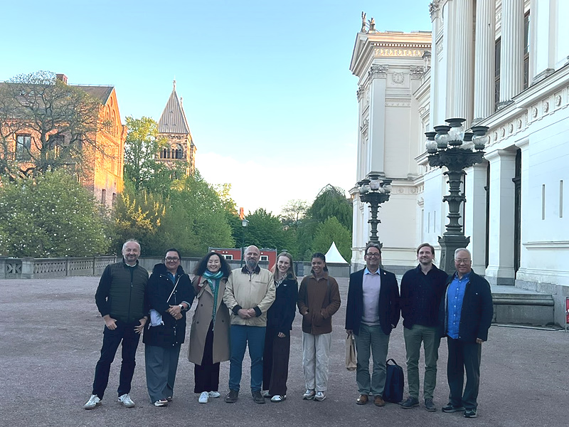 On 12-13 May 2026, another consortium meeting of the TWIN-Waters project took place, this time hosted by Lund University in Sweden. It was already the third meeting of the project partners, following previous gatherings at the University of the West of England in Bristol and at Wrocław University of Environmental and Life Sciences. The event was attended by representatives of IGIG: dr Paweł Bogusławski and dr Natalia Wielgocka, as well as team members from the Institute of Environmental Engineering - dr Radosław Stodolak, and dr Aleksandra Bawiec. more...
Cooperation between the Wrocław University of Environmental and Life Sciences and Virtual City Systems
20-05-2026
 In May of this year, at the initiative of the Institute of Geodesy and Geoinformatics, an agreement was signed between the Wrocław University of Environmental and Life Sciences and the company Virtual City Systems. This agreement enables the use of software for teaching and research purposes. more...
IGiG Summer Internships 2026
12-05-2026
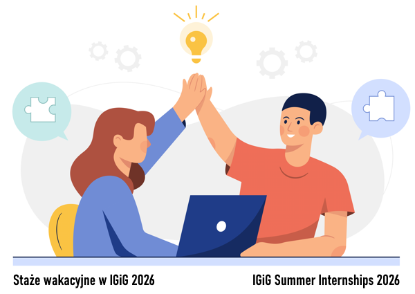 The Institute of Geodesy and Geoinformatics presents a proposal of paid summer internships for students for 2026. The internships duration is up to three months. The titles and topics of the internships are in the appendix. The deadline for submitting applications is June 1, 2026. Please contact the tutors of individual internships directly (e-mail). more...
IGiG Scientific Seminar - Dr. Guohao Zhang
16-04-2026
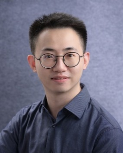 The Institute of Geodesy and Geoinformatics kindly invites you to a scientific seminar entitled "Advancing GNSS in Challenging Environments: From Intelligent Positioning to Ubiquitous Sensing", to be delivered by Dr. Guohao Zhang, Department of Aeronautical and Aviation Engineering, The Hong Kong Polytechnic University. The seminar will take place in the IGiG library, room 100G, on 27 April 2026 (Monday) at 9:30 a.m.
The abstract and the speakers biographical note.
Archive: | 1 | 2 | 3 | 4 | 5 | 6 | 7 | 8 | 9 | 10 | 11 | 12 | 13 | 14 | 15 | 16 | 17 | 18 | 19 | 20 | 21 | 22 | 23 | 24 | 25 | 26 | 27 | 28 | 29 | 30 | 31 | 32 | NEXT PAGE »
 |
 |
 |
 |
Contact
|
INSTITUTE OF GEODESY AND GEOINFORMATICS
Wroclaw University of Environmental and Life Sciences Grunwaldzka 53 50-357 Wroclaw NIP: 896-000-53-54, REGON: 00000 18 67 Phone +48 71 3205617 Fax +48 71 3205617 e-mail: igig@upwr.edu.pl |