News
ISPRS Webinar
16-06-2021
ISPRS WG IV/1 cordially invites you to the "Introduction to CityJSON" webinar, which will take place on 1 July, 2021 at 6 pm (CEST). The issues related to the basics of the CityJSON format and the creation of 3D city models will be presented by Dr. Ken Arroyo Ohori, researcher from the 3D geoinformation group, TU Delft. He is a co-creator of the CityJSON format and the model construction and processing tools. Participation in the webinar is free and requires prior registration: register
We would also like to take this opportunity to invite you to participate in a lecture given by prof. Monika Sester (Leibniz University, Germany) "Capture and Interpretation of Mobility Data", which will take place on 29 June, 2021 at 2 pm (CEST). This is one of the ISPRS Keynote Series lectures aimed at introducing interesting topics in the field of geoinformation, remote sensing and photogrammetry. Participation in the lecture is free and requires prior registration: register
We would also like to take this opportunity to invite you to participate in a lecture given by prof. Monika Sester (Leibniz University, Germany) "Capture and Interpretation of Mobility Data", which will take place on 29 June, 2021 at 2 pm (CEST). This is one of the ISPRS Keynote Series lectures aimed at introducing interesting topics in the field of geoinformation, remote sensing and photogrammetry. Participation in the lecture is free and requires prior registration: register
Summer internships in IGG
01-06-2021
The Institute of Geodesy and Geoinformatics presents a proposal of summer internships for students. The internships duration is three months. The titles and topics of the internships are in the appendix. The deadline for submitting applications is June 15, 2021. Please contact the tutors of individual internships directly (e-mail).
 more...
 more...
Scientists from UPWr and ESA have solved Einstein’s puzzle resulting from general relativity
28-03-2021

Although Einstein’s general theory of relativity is over 100 years old, it still contains a plethora of as yet undescribed phenomena. Scientists from the Institute of Geodesy and Geoinformatics (IGG UPWr) together with representatives of the European Space Agency (ESA) have published an article that comprehensively describes what happens with artificial satellites orbiting the Earth and how the theory of general relativity affects the orbits of satellites. The authors discovered some unexpected effects and predictions that have never been described in the literature before. Prof. Krzysztof Sośnica presented results from this study in October 2020 and in March 2021 at the meeting of the GNSS Scientific Advisory Committee of the European Space Agency (GSAC) as part of a special invited paper, which triggered a heated discussion. Now, these results have been published in Celestial Mechanics and Dynamical Astronomy by Springer Nature.
 more...
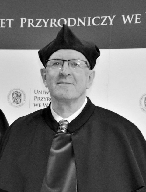
Prof. Andrzej Borkowski, Director of the Institute of Geodesy and Geoinformatics, passed away
13-03-2021
After a long struggle with a serious illness, Prof. Andrzej Borkowski, Director of the Institute of Geodesy and Geoinformatics, passed away 13.03.2021 at the age of 61.
He was a member of the UPWr Senate, a member of the International Association of Geodesy and the Geodesy Committee of the Polish Academy of Sciences, a correspondent member of the German Commission of Geodesy at the Bavarian Academy of Sciences. He was our colleague, friend and mentor.
He was the supervisor of 9 doctoral dissertations, author or co-author of 220 scientific articles and conference reports, a person endowed with outstanding mathematical talent and an unusual sense of humor. A person who is absolutely honest and devoted to scientific work.

Integrated movement science - new research field
05-03-2021

An international group of scientists, including researchers from the SpaceOs Wroclaw University of Environmental and Life Sciences, lead by Dr. Urška Demšar from the University of St Andrews, published an article in the International Journal of Geographical Information Science entitled "Establishing the integrated science of movement: bringing together concepts and methods from animal and human movement analysis" . The aim of the paper is to unify the two fields of science - human and animal mobility analysis, identifying similarities and differences between them.
 more...
Archive: « PREVIOUS PAGE | 1 | 2 | 3 | 4 | 5 | 6 | 7 | 8 | 9 | 10 | 11 | 12 | 13 | 14 | 15 | 16 | 17 | 18 | 19 | 20 | 21 | 22 | 23 | 24 | 25 | 26 | 27 | 28 | 29 | 30 | NEXT PAGE »
 |
 |
 |
 |
Contact
|
INSTITUTE OF GEODESY AND GEOINFORMATICS
Wroclaw University of Environmental and Life Sciences Grunwaldzka 53 50-357 Wroclaw NIP: 896-000-53-54, REGON: 00000 18 67 Phone +48 71 3205617 Fax +48 71 3205617 e-mail: igig@upwr.edu.pl |