
News
24th Polish Scientific Symposium Photogrammetry, Remote Sensing and Geoinformation in Digital Reality Modeling
29-09-2026
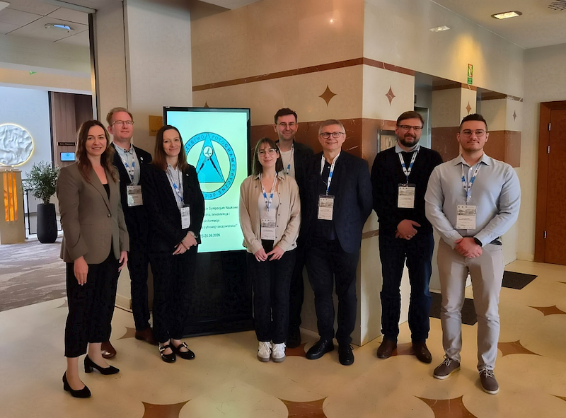
From 23 to 25 September 2026, researchers from Wrocław University of Environmental and Life Sciences took part in the 24th Polish Scientific Symposium “Photogrammetry, Remote Sensing and Geoinformation in Digital Reality Modeling” held in Kielce.
The event was organized by the Polish Society for Photogrammetry and Remote Sensing (PTFiT), the Main Board of the Association of Polish Surveyors (SGP) and the Department of Geodesy and Geomatics at Kielce University of Technology.
Over the three days of the symposium, researchers from the Institute of Geodesy and Geoinformatics presented work spanning a broad range of topics – from photogrammetry and laser scanning to machine learning, BIM and digital twins.
Four contributions involving our researchers were presented during the oral sessions:
Edyta Hadaś presented research on tree crown segmentation and species recognition in orchards using UAV point clouds, conducted together with Michael Kölle and Norbert Haala from the University of Stuttgart. The study focused on automatic fruit-tree crown segmentation, extraction of geometric parameters, and species recognition.
Piotr Gołuch presented a photogrammetric method for transferring height from a benchmark with limited accessibility, developed together with Kazimierz Ćmielewski. The single-image
approach is designed for height transfer in situations where direct access to the benchmark is restricted.
Adam Pałęcki presented research on automatically determining geometric parameters of wheat ears from photogrammetric point clouds, conducted with Małgorzata Jarząbek-Rychard and Grzegorz Jóźków. The proposed method uses automated plant organ segmentation to extract geometric parameters of individual wheat ears from dense point clouds.
Dorota Włodarczyk presented research on the automatic orientation of indoor images with respect to BIM models using integrated semantic and geometric information, conducted together with Grzegorz Jóźków and Małgorzata Jarząbek-Rychard. The proposed approach combines semantic image analysis with 2D–3D line correspondences to estimate the orientation of a single image within the BIM coordinate system.
Two further contributions involving our researchers were included in the poster session:
The UPWr Digital Twin project was presented by Piotr Królik and Przemysław Tymków and co-authored by Marta Lewińska and Dominik Szostak. The project focuses on creating digital representations of university buildings – from mobile laser scanning and point-cloud processing to online data access and integration into a digital twin ecosystem.
LidarBathySeg, focusing on an open-source tool for automated processing and segmentation of water surface and bottom from airborne bathymetric LiDAR data, was presented by Tomasz Kogut from Maritime University of Szczecin and co-authored by Małgorzata Jarząbek-Rychard, as well as Karol Kabała and Arkadiusz Tomczak, also from Maritime University of Szczecin.
The symposium also provided an opportunity to meet researchers and geoinformation professionals from across Poland, exchange experiences, and discuss current developments in photogrammetry, remote sensing, and spatial data technologies.
Many thanks to the organizers and all participants for three days of presentations, discussions and meetings!
The event was organized by the Polish Society for Photogrammetry and Remote Sensing (PTFiT), the Main Board of the Association of Polish Surveyors (SGP) and the Department of Geodesy and Geomatics at Kielce University of Technology.
Over the three days of the symposium, researchers from the Institute of Geodesy and Geoinformatics presented work spanning a broad range of topics – from photogrammetry and laser scanning to machine learning, BIM and digital twins.
Four contributions involving our researchers were presented during the oral sessions:
Edyta Hadaś presented research on tree crown segmentation and species recognition in orchards using UAV point clouds, conducted together with Michael Kölle and Norbert Haala from the University of Stuttgart. The study focused on automatic fruit-tree crown segmentation, extraction of geometric parameters, and species recognition.
Piotr Gołuch presented a photogrammetric method for transferring height from a benchmark with limited accessibility, developed together with Kazimierz Ćmielewski. The single-image
approach is designed for height transfer in situations where direct access to the benchmark is restricted.
Adam Pałęcki presented research on automatically determining geometric parameters of wheat ears from photogrammetric point clouds, conducted with Małgorzata Jarząbek-Rychard and Grzegorz Jóźków. The proposed method uses automated plant organ segmentation to extract geometric parameters of individual wheat ears from dense point clouds.
Dorota Włodarczyk presented research on the automatic orientation of indoor images with respect to BIM models using integrated semantic and geometric information, conducted together with Grzegorz Jóźków and Małgorzata Jarząbek-Rychard. The proposed approach combines semantic image analysis with 2D–3D line correspondences to estimate the orientation of a single image within the BIM coordinate system.
Two further contributions involving our researchers were included in the poster session:
The UPWr Digital Twin project was presented by Piotr Królik and Przemysław Tymków and co-authored by Marta Lewińska and Dominik Szostak. The project focuses on creating digital representations of university buildings – from mobile laser scanning and point-cloud processing to online data access and integration into a digital twin ecosystem.
LidarBathySeg, focusing on an open-source tool for automated processing and segmentation of water surface and bottom from airborne bathymetric LiDAR data, was presented by Tomasz Kogut from Maritime University of Szczecin and co-authored by Małgorzata Jarząbek-Rychard, as well as Karol Kabała and Arkadiusz Tomczak, also from Maritime University of Szczecin.
The symposium also provided an opportunity to meet researchers and geoinformation professionals from across Poland, exchange experiences, and discuss current developments in photogrammetry, remote sensing, and spatial data technologies.
Many thanks to the organizers and all participants for three days of presentations, discussions and meetings!
 back
back |
 |
 |
 |
Contact
|
INSTITUTE OF GEODESY AND GEOINFORMATICS
Wroclaw University of Environmental and Life Sciences Grunwaldzka 53 50-357 Wroclaw NIP: 896-000-53-54, REGON: 00000 18 67 Phone +48 71 3205617 Fax +48 71 3205617 e-mail: igig@upwr.edu.pl |