News
Geoid or GNSS processing method? What determines the accurate determination of mountain peak heights?
24-02-2026
The height of mountain peaks can be determined using precise GNSS geodetic measurements. However, it should be remembered that GNSS measurements provide ellipsoidal heights – referenced to a mathematical reference surface (ellipsoid). To obtain the height above sea level, a transformation using a geoid model, i.e., a physical surface corresponding to the average sea level, is necessary.

If the geoid model used is inaccurate or inconsistent (e.g. in country border areas), even the most advanced GNSS hardware and processing approach will not provide the correct physical height. In addition, there are several techniques for processing GNSS observations: real-time solutions (Real-Time Network - RTN, Real-Time Kinematic - RTK), static differential solutions or absolute Precise Point Positioning (PPP) approach. In practice, what has a greater impact on the accuracy of height determination in mountainous terrain – the geoid model or the GNSS processing technique?
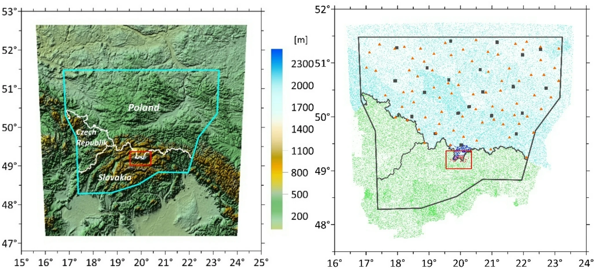
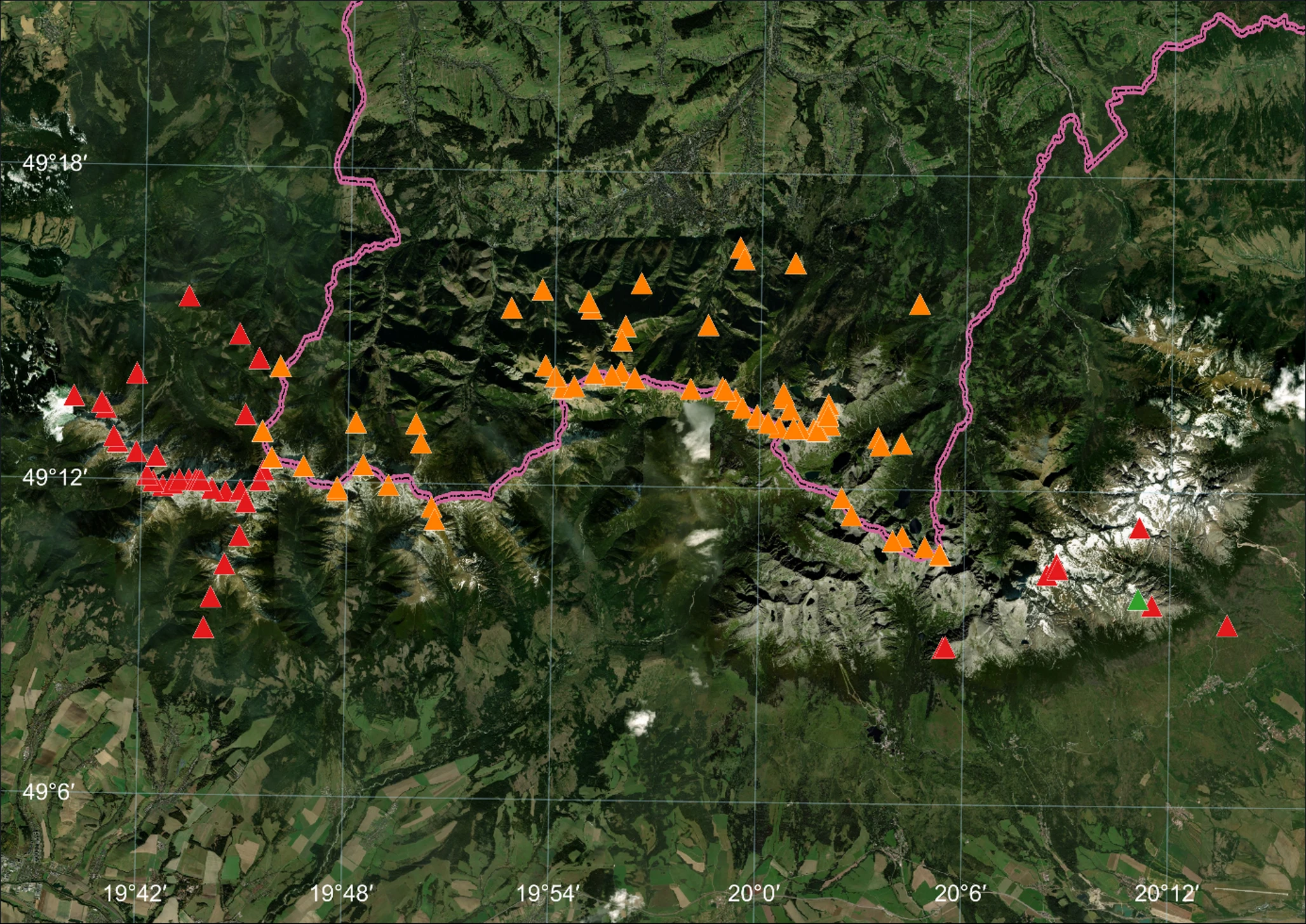
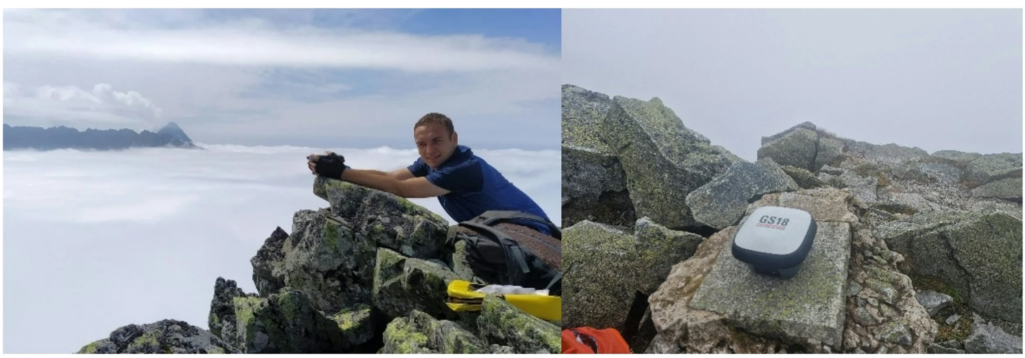
The answer to this question can be found in an article published in GPS Solutions, which analysed the error budget for GNSS height determination in mountainous terrain, focusing on two key factors: (1) the model of the geoid/quasi-geoid used and (2) the processing technique of GNSS observations. The heights of 113 peaks and passes in the Tatra Mountains (on the Polish and Slovakia side) were determined using RTN solutions with testing different geoid models: taking into account constant and variable topographic density, as well as quasi-geoid models (national and regional for the Tatra Mountains area). In addition, for the Slavkovský štít peak, various calculation approaches were compared: RTN, RTK, static solutions and PPP.
The results indicate that the dominant component of the error budget in the transformation of ellipsoidal heights to physical heights is the geoid model. The differences between the models reach several centimetres. However, the choice of GNSS processing technique is of much less importance, provided that tropospheric delay is modeled correctly. If this is neglected, the error can reach several centimetres, whereas with correct modeling, the differences between GNSS techniques remain at the level of single centimetres. Fast RTN solutions enable an accuracy of ≤ 5 cm to be achieved even with large differences in height between the receiver and the reference station. This means that in mountainous conditions, it is the quality of the geoid model, rather than the GNSS processing technique itself, that is currently the main limitation to the accuracy of height determination.
For more information, see the article:
Strugarek, D., Trojanowicz, M., Mikoś, M. et al. (2026). Height determination based on GNSS measurements in the mountainous area: contribution of the geoid model and data processing technique to the overall error budget. GPS Solut 30, 78
https://doi.org/10.1007/s10291-026-02043-7.
This study was supported by the National Science Center, Poland, grant no. UMO-2021/42/E/ST10/00020. The field measurements were financed in the framework of the Leading Research Group for Space And Close Earth Observation Sciences “SpaceOS” at the UPWr. The APC is financed by Wrocław University of Environmental and Life Sciences.
 back
back |
 |
 |
 |
Contact
|
INSTITUTE OF GEODESY AND GEOINFORMATICS
Wroclaw University of Environmental and Life Sciences Grunwaldzka 53 50-357 Wroclaw NIP: 896-000-53-54, REGON: 00000 18 67 Phone +48 71 3205617 Fax +48 71 3205617 e-mail: igig@upwr.edu.pl |